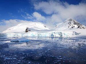
Rongé Island
| Rongé Island | ||
|---|---|---|
| Waters | Errera Canal | |
| Geographical location | 64 ° 42 ′ 42 ″ S , 62 ° 40 ′ 54 ″ W | |
|
|
||
| length | 8 kilometers | |
| Highest elevation |
Mount Britannia 1160 m |
|
The Rongé Island ( French Île De Rongé ) is an 8 km long and mountainous island off the Danco coast of Graham Land in the north of the Antarctic Peninsula . It is the largest of the islands in a group on the west side of the Errera Channel .
Participants in the Belgica expedition (1897–1899) led by the Belgian polar explorer Adrien de Gerlache de Gomery discovered them in February 1898. It is named after Madame de Rongé, a cousin of the German clergyman Johannes Ronge and sponsor of the research trip .
Web links
- Rongé Island in the Geographic Names Information System of the United States Geological Survey (English)
- Rongé Island on geographic.org (English)

