
Rue Demarquay
| Rue Demarquay | |
|---|---|
| location | |
| Arrondissement | 10. |
| quarter | Saint-Vincent-de-Paul |
| Beginning | 23, rue de l'Aqueduc |
| The End | 190, rue du Faubourg-Saint-Denis |
| morphology | |
| length | 156 m |
| width | 12.6 m |
| history | |
| Emergence | 1882 |
| designation | 1882 |
| Coding | |
| Paris | 2697 |

The Rue Demarquay is a street in the Quartier Saint-Vincent-de-Paul of the 10th arrondissement in Paris .
location
Rue Demarquay begins at number 23 on rue de l'Aqueduc and ends after 156 meters at number 190 on rue du Faubourg-Saint-Denis. The street is a quiet residential street near two train stations, the Gare de l'Est and the Gare du Nord . No other road crosses its course.
Name origin
The road, completed in 1882, was named after the surgeon Jean Nicolas Demarquay (1815–1875), who was the chief physician at the Maison de santé Dubois , now the Hôpital Fernand-Widal . The hospital is across the street.
history
The street, which is 12.60 meters wide, has residential developments from two different eras on both sides. The northern side, with six-story houses and alternating facade decorations, has been preserved from the 1870s, when the street was built. The southern side was completely demolished and rebuilt in the 1980s.
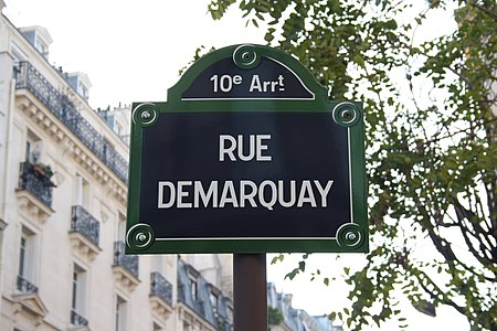
Street sign on the corner of Rue de l'Aqueduc
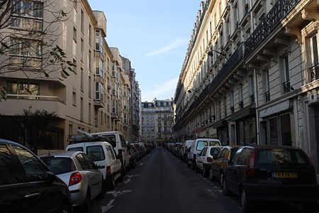
View of Rue Demarquay: right buildings from the 1870s, left new buildings from the 1980s

Attractions
- On the north side there are buildings from the 19th century, which are arranged ascending on the hill from Rue de l'Aqueduc to Rue du Faubourg – Saint – Denis. On the south side there are more recent buildings. The last building on the corner of Rue de l'Aqueduc even dates from 1985–1990.
- The bunker at the Gare de l'Est.
literature
- Jacques Hillairet: Dictionnaire Historique des Rues de Paris. Éditions de Minuit , Paris, 1963, ISBN 2-7073-0092-6 .
- Laure Beaumont-Maillet: Vie et histoire du Xe arrondissement. Éditions Hervas, Paris, 1988, ISBN 2-903118-35-3 .
Web links
Individual proof
- ↑ Historix (fr)
- ^ “Un bunker secret sous la gare de l'Est” , on leparisien.fr
- ↑ "Un bunker sous la gare de l'Est" , on lebonbon.fr
Coordinates: 48 ° 52 ′ 51 ″ N , 2 ° 21 ′ 33 ″ E