Rugāji
| Rugāji | ||
|---|---|---|
 Help on coat of arms |
|
|
| Basic data | ||
| State : |
|
|
| Landscape: | Latgale ( Latvian : Latgale ) | |
| Administrative district : | Rugāju novads | |
| Coordinates : | 57 ° 0 ' N , 27 ° 8' E | |
| Residents : | 585 (Jun 3, 2015) | |
| Area : | ||
| Population density : | ||
| Height : | 102 m | |
| Website: | www.rugaji.lv | |
| Post Code: | ||
| ISO code: | ||
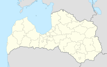
Rugāji is a place in eastern Latvia and the center of the district of the same name (Rugāju novads).
The place arose after a municipal administration was established in 1922. The place name was derived from the miller of the local estate. In 2009, together with the municipality of Lazdukalns, the current district was formed, which has 2652 inhabitants.
literature
- Astrīda Iltnere (ed.): Latvijas Pagasti, Enciklopēdija. Preses Nams, Riga 2002, ISBN 9984-00-436-8 .
