Sadamisaki Peninsula
| Sadamisaki Peninsula | ||
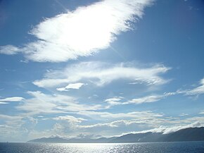
 View of the peninsula from the sea |
||
| Geographical location | ||
|
|
||
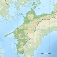
| Coordinates | 33 ° 26 ' N , 132 ° 12' E | |
| Waters 1 | Seto Inland Sea | |
| length | 40 km | |
| width | 6.4 km | |
| surface | 95 km² | |
The Sadamisaki Peninsula ( Japanese 佐 田 岬 半島 , Sadamisaki-hantō ), also Misaki Peninsula ( 三 崎 半島 , Misaki-hantō ), is a peninsula on the main Japanese island of Shikoku . It is named after Cape Sada-misaki ( 佐 田 岬 ; 33 ° 20 ′ 33 ″ N , 132 ° 0 ′ 54 ″ E ), which is the westernmost point of the island. Administratively it is largely identical to the municipality of Ikata (8,540 inhabitants, as of October 1, 2019) in the Ehime prefecture .
The peninsula is 40 km long, but its widest point is only 6.4 km and the narrowest point is 0.8 km. The total area is 95 km². The peninsula separates the marine region Iyo-nada of the Seto Inland Sea from the Uwa Sea ( 宇 和 海 , Uwa-kai ) of the Bungo Canal , which separates Shikoku from Kyūshū , but depending on the definition, the Seto Inland Sea is also included. The Hōyo Strait is located between the Sadamisaki Peninsula and the Saganoseki Peninsula opposite from Kyūshū . The highest point on the peninsula is Mount Garan-san ( 伽藍 山 ; 33 ° 24 ' N , 132 ° 7' E ) with 414.2 m.
Individual evidence
- ↑ 佐 田 岬 半島 . In: 日本 大 百科全書 at kotobank.jp. Retrieved March 15, 2015 (Japanese).
- ↑ 豊 予 海峡 . In: 百科 事 典 マ イ ペ デ ィ ア at kotobank.jp. Retrieved March 15, 2015 (Japanese).
