Sandwip
| Sandwip | ||
|---|---|---|
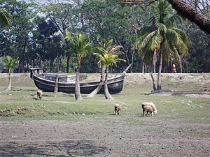
| Fishing boat on Sandwip | ||
| Waters | Bay of Bengal | |
| Geographical location | 22 ° 31 ' N , 91 ° 30' E | |
|
|
||
| length | 26.3 km | |
| width | 9.9 km | |
| surface | 257 km² | |
| Residents | 472.179 (2009) 1837 inhabitants / km² |
|
| NASA satellite image | ||
Sandwip is an island in the east of Bangladesh and is located in the Meghna Delta in the Bay of Bengal . The island, which belongs to the province of Chittagong , is separated from the port city of Chittagong by the Sandwip Canal . About 472,000 people live on the island, which is 26 km long and 10 km wide. The residents of Sanwipe can look back on an approximately 3,000 year history in which the residents were able to maintain their independence.
In the 17th century the island was the base of Portuguese and Arakanese pirates. Today Sandwip belongs to Bangladesh and is one of the poorer regions of the country with a higher rate of illiteracy.
The island is administratively divided into 15 districts:
- Azimpur
- Bauria
- Haramia
- Horishpur
- Kalapania
- Maitbhanga
- Mogdhara
- Musapur
- Santoshpur
- Gachua
- Amanullah
- Rahmatpur
- Sharikiat
- Deergha par
economy
The island was largely formed by sedimentary deposits from the Meghnas. The nutrient-rich sediment soil enables cultivation and a. of dates , rice , mangoes , melons and coconuts .
In addition to farming, the island's inhabitants make a living from shipbuilding and selling salt. Remittances from emigrated residents of Sandwips from the United States and the Emirates enabled housing construction and healthcare investments.


