Sango Brook
|
Sango Brook Sango-shipu |
||
|
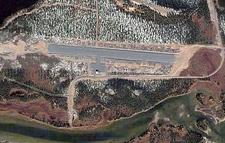
Natuashish Airport with Sango Brook at the bottom of the picture |
||
| Data | ||
| location | Labrador in Newfoundland and Labrador ( Canada ) | |
| River system | Sango Brook | |
| Source height | approx. 520 m | |
| muzzle |
Sango Bay , Labrador Sea ( Atlantic Ocean ) Coordinates: 55 ° 53 ′ 25 " N , 61 ° 11 ′ 3" W 55 ° 53 ′ 25 " N , 61 ° 11 ′ 3" W |
|
| Mouth height | 0 m | |
| Height difference | approx. 520 m | |
| Bottom slope | approx. 5.5 ‰ | |
| length | approx. 95 km | |
| Catchment area | 806 km² | |
| Flowing lakes | Mishta-natuashu, Natuashish | |
| Communities | Natuashish | |
The Sango Brook , also Sango-shipu , is an approximately 95 km long tributary of the Labrador Sea in the east of Labrador in the Canadian province of Newfoundland and Labrador .
River course
The Sango Brook rises at an altitude of 520 m in the central east of the Labrador Peninsula . From there it flows in a predominantly east-northeast direction. Lake Mishta-natuashu is located on the course of the river between river kilometers 27 and 10 . The airfield of the settlement Natuashish is at river kilometer 4 on the north bank of the river. The Sango Brook flows 3 km above the mouth of the small lake Natuashish , on the northeastern bank of which is the settlement of the same name. The Sango Brook finally flows into the northwest shore of Sango Bay . The catchment area of the Sango Brook covers 806 km².
Fish fauna
The Sango Brook is one of the northernmost rivers in Labrador with a population of Atlantic salmon . The arctic char also occurs in the river system. At river kilometer 85.3 there is a 4.6 m high waterfall, which is an insurmountable obstacle for migratory fish .
Web links
- Sango Brook at Natural Resources Canada
