
Santa Bárbara (Vila do Porto)
| Santa Bárbara | ||||||
|---|---|---|---|---|---|---|
|
||||||
| Basic data | ||||||
| Autonomous Region : | Azores | |||||
| Concelho : | Vila do Porto | |||||
| Coordinates : | 36 ° 59 ′ N , 25 ° 4 ′ W | |||||
| Residents: | 405 (as of June 30, 2011) | |||||
| Surface: | 15.27 km² (as of January 1, 2010) | |||||
| Population density : | 27 inhabitants per km² | |||||
| Postal code : | 9580-115 | |||||
| politics | ||||||
| Mayor : | André Bairos Moura | |||||
| Address of the municipal administration: | Junta de Freguesia de Santa Bárbara Termo da Igreja de Santa Bárbara 9580-115 Santa Bárbara |
|||||


Santa Bárbara is a municipality ( freguesia ) in the district ( concelho ) of Vila do Porto , on the Portuguese Azores island of Santa Maria . 405 people live in the community (as of June 30, 2011) on 15.3 km². The population density is 27 inhabitants per km².
gallery

View over Santa Bárbara

Baía de São Lourenço with Ilhéu de São Lourenço

Poço da Pedreira
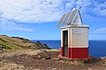
Beacon on the Ponta do Norte


.jpg)

Web links
Commons : Santa Bárbara - Collection of images, videos and audio files
Individual evidence
- ↑ www.ine.pt - indicator resident population by place of residence and sex; Decennial in the database of the Instituto Nacional de Estatística
- ↑ Overview of code assignments from Freguesias on epp.eurostat.ec.europa.eu

Freguesias in the concelho Vila do Porto