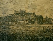
Castle Ground (Bratislava)
Schlossgrund or Schlossgrund-Zuckermantel ( Podhradie in Slovak ) is a (now unofficial) district of Bratislava in the Staré Mesto district (old town), which was an independent place until 1848. Although legally part of Bratislava, the de facto incorporation did not take place until 1851.
The district had names in the various languages that cannot always be translated directly. The castle grounds were called plaga Subarcensis or Suburbium in Latin . In Hungarian he was called Várallya . All names have several variants, with the German name Zuckermantel , for example, there were the variants Zuckermantl or Zuckermand (e) l . Schlossgrund-Zuckermantel extended around 1800 to the east (eastern slope of the castle hill), south (along the Danube ) and partly west (to Mlynská dolina ) of Bratislava Castle .
In the 1960s and 1970s, much of the area was demolished because of the construction of the New Bridge .
Originally the whole castle hill was called “Schlossgrund” because it was the property of the castle. Since the 13th century, only the immediate vicinity of the castle has been called the castle grounds. From the 13th century onwards, the vicus sancti Nicolai was referred to as the suburbium (German, freely translated as St. Nicholas' settlement , in Slovak usually translated as Osada svätého Mikuláša ); it still belonged to the castle when the town east of the settlement was granted town charter in 1291. In addition, in the late Middle Ages, all settlements in front of the city walls (i.e. the suburbs) and, alternatively, the entire city below the castle were referred to as suburbium.
In modern times, the castle grounds consisted of the following parts:
-
Sugar coat in a broader sense:
- Sugar coat in the narrower sense (between the castle and the Danube)
- Schlossberg (between the castle and the city, including the St. Nicholas settlement)
- Hausbergl (west of the castle to the Mühltal - Mlynská dolina )
In 1848/1851 the entire castle grounds were incorporated into the city of Pressburg together with the settlement Weidritz (Slovak Vydrica ) under the name Theresienstadt (Hungarian Terézváros ). The new district was named after Maria Theresa .
The buildings worth mentioning that have survived include the Haus zum Guten Hirten (clock museum), the Zsigray curia (museum of Jewish culture), the former town hall east of the castle, the Trinity Church , the Kamper curia (archaeological museum of the SNM ), the Brammer -Kurie (or Brammer House ) and the fish guild house south of the castle.
literature
- Ján Lacika: Bratislava . DAJAMA, Bratislava 2000. ISBN 80-88975-16-6
- Vladimír Horváth: Bratislavský topografický lexikon . Bratislava 1990.
Coordinates: 48 ° 8 '25.5 " N , 17 ° 6' 2.4" E

