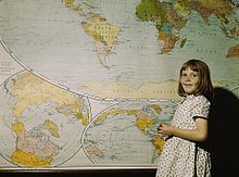
School card
A school card is a card that is used as a teaching aid in class and / or for homework.
The scale, content and graphic diversity of the maps enables numerous classification principles, of which, however, only those that are of interest for practical classroom work will be mentioned (2009).
According to the standard
We are only interested in the conceptual delimitation of "plan" and "map". All map sketches up to a scale of 1:10 000 count as a plan (e.g. plans of the school premises and the home town). The conceptual demarcation to the map should not be interpreted in terms of scale, however, rigidly; the transition is fluid. There are city maps of large cities, for example, on a scale of 1:20,000 or 1:25,000. a. characterized in that many objects (especially buildings) are still shown in true-to-scale and positionally accurate floor plans. In the smaller scales, the maps (e.g. district map 1: 100,000, Germany map 1: 2000,000), the generalization of the content and the form is increasingly being used, selected objects are represented by pictorial symbols or abstract signatures shown. Very simplified, small-scale (overview) city maps (e.g. 1:75,000, 1: 150,000 or 1: 200,000) can be referred to as "city maps".
According to the usage and external appearance
This structuring principle characterizes the basic didactic purpose of the card as a frontal teaching medium or as a student work tool .
- Digital card forms (not further subdivided here)
- Analog card shapes (print media)
- Frontal teaching media
- Wall and poster cards
- Projection film cards (transparent cards)
- Student work equipment
- Hand cards
- Atlas (as a systematically ordered and bound compilation of maps)
- Textbook cards
- Work cards (e.g. hand outline maps, map sketches in workbooks).
- Frontal teaching media
According to the content (thematic) design
The qualitative and content-related differentiation of the cards, often graphically designed in a typical way, leads to the principle of dividing card types (card types), which are, however, subordinate to the card shapes . In accordance with this classification principle, broken down into subject areas, the following card types can be identified:
- General-geographic map ( "physical card" topographic base map)
- Thematic maps
- Physical-geographical maps (e.g. geological maps, vegetation maps, climate maps)
- Anthropogeographic maps (e.g. population maps, location maps of the economy, traffic maps)
- Maps on history (e.g. rulership / area of power maps, location maps of castles and palaces, maps of peoples' movements and theaters of war)
- Maps on other topics (e.g. environment, religion, politics).
There are often technical overlaps between the anthropogeographic maps and the maps of history, for example in administrative maps, settlement maps or population maps.
According to the structure level
- Analytical maps (element maps, e.g. maps for mining, traffic or agricultural use)
- Complex maps (e.g. general geographic map, maps of industry and agriculture, complete economic map)
- Synthesis maps (e.g. climate type map, map of vegetation zones).
According to the order of meaning
- Main maps (overview maps with relatively complex statements)
- Additional cards (cards with regionally or thematically restricted statements).
literature
- Breetz, Egon: Classification of cartographic teaching materials. In: To understand maps in local history and geography lessons. (East) Berlin 1975, pp. 21-25.
- Ogrissek, Rudi: Card classification and analog terminology in theory and practice. In: Peterm. Geogr. Mitt., H. 1/1980, pp. 75-82.
See also
- General geographic map
- Cartographic teaching material
- District map series
- Student hand card
- School atlas
- School wall map
- Thematic map
