
School wall map

The school wall map is a map for class instruction in school classes. Its main task is to enable all students in a class to view a thematically treated geographical (or geography-influenced) subject together.
execution
Material basis
The cards are in the appropriate format, plano cards on firm paper or laminated fabric with stiffening and hanging devices and usually rollable. In most cases, they are not simply enlargements of atlas maps , but rather special designs. For better orientation, they usually have the same sheet lines and graphic designs as according to scale smaller student hand - or school atlas maps , which is particularly important for the lower grades (grades 2-5).

Application of a map part to the carrier material

Stroking the map part

All parts brought together


Formats
School wall maps can be divided into three size groups:
- Small-format wall maps up to approx. 1.0 m²
- Medium format wall maps approx. 1.0 to 3.0 m²
- Large format wall maps over approx. 3.0 m².
In addition to simple wall hooks, small to medium-sized cards are often attached to card stands or card platforms with slide rails. Medium-sized wall maps are best suited for visual perceptibility and handling in frontal school lessons .
Large-format wall maps - especially those with "excess lengths" (heights of approx. 2.0 m and more) - can primarily be used as permanent materials for school lessons. They are often hung on side walls. They are also predestined for university teaching in large lecture halls with rising stalls. "Over-widths" (widths of approx. 2.0 m and more) are not recommended for the school for safety reasons.
In school cartography in the GDR, limit values of the format have been in effect for every new wall map development since the mid-1970s :
- 2.00 m width
- 1.75 m height (length).
This format limitation was subordinate to the choice of scale and page cut.
application

The wall map serves as a teaching medium , especially in frontal teaching, didactically and methodically for concentration and control of the lesson, demonstrating work techniques (e.g. cartometric exercises, profile creation) and enables the targeted attention of all students under the guidance of the teacher.
Like hardly any other medium, the wall map has shaped geography lessons as well as history , politics and religious education .
The spatial image of the world was and is significantly shaped by school wall maps. At the latest, the school leaver thinks “in maps” when it comes to geographical orientations, for example, as a tourist he goes “up” to Denmark or “down” to Sicily.
In the past few decades, school wall maps have faced competition from map offers in the form of transparent film folders for use on overhead projectors / overhead projectors . The overlay technique in particular enabled new methodological variants (also for work lessons). Today, school wall maps in the classroom are increasingly being competed and replaced by digital atlas products from the publishing houses offering them in combination with interactive whiteboards .
history
Due to their versatility and the low purchase costs, wall maps were probably the oldest school maps ( one map for all students in class). Wall maps are said to have been used sporadically as a teaching aid (especially for religious instruction) in Latin schools in the 16th century. The first school wall maps were not officially developed until the 18th century. In the first half of the 19th century there were around 25 titles or editions in Germany alone that were shown as "school wall maps" or "wall maps for schools" in lists of offers.
A new era began for the publisher Justus Perthes Geographische Anstalt Gotha with the multicolored wall map "Asia" published by the officer and geography teacher Emil von Sydow in 1838. This wall map was the entrance to his “Methodical Wall Atlas”, which consists of several titles. Von Sydow, who is regarded as the founder of methodical school cartography in Germany, introduced the "principle of regional colors ", the "principle of methodological simplification" and the "principle of increasing the long-distance effect of wall maps". As a revision of von Sydow's wall map work, the “Sydow-habenicht Methodischer Wandatlas” was published in the Gotha publishing house in 1896. In the following years v. Sydow's design principles were refined and expanded primarily by the geographer and cartographer Hermann Haack (Large Geographical Wall Atlas - 1907; Large Historical Wall Atlas - 1917; among others), as well as, after the expropriation of the Gothaer Verlag, also by Werner Painke, student of Hermann Haack, in the extensive, Completely new wall map program on geography and history in 'Justus Perthes Geographischer Verlagsanstalt Darmstadt' (1953 to 1994).

Hand-drawn school wall map of Chemnitz-Ebersdorf in the school museum there

School wall map from before the First World War.

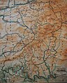
Details of a district map (Hannover and Linden)
School wall map from the Waldbröl district from the 1960s


In 1903, the Georg Westermann / Braunschweig publishing house published the first wall maps with the titles “Province of Brandenburg” and “Palestine”, edited by the teacher and school geographer Carl Diercke . Later, varied regional and thematic wall map programs were developed.
Both producing book and map publishers, who also published the first German general education school atlases in the middle of the 19th century and whose school cartographic products with their content, graphic and publication variants largely determined the profile of the publishing houses in the following years, can be regarded as world-famous “royal houses of the German school cartography ”. Older insiders see the two publishers in a different light: Justus Perthes in Gotha and Darmstadt and VEB Haack Gotha (1953–1991) are best known for their wall maps ; Westermann through the school atlases, mainly through the world atlas "Diercke", which has been edited over a hundred times, and through the varieties of other atlases. All these publishers, the Gothaer Geographisch-Kartographische Anstalt Justus Perthes, Justus Perthes Geographische Verlagsanstalt Darmstadt, the VEB Haack Gotha and the predominantly geographically oriented company Westermann in Braunschweig, also had wall maps for the "back of the school cartography" for the subject of history - and Z. Sometimes there is also something left in the Atlas range.
Card shapes

School wall maps can be created as individual maps . As Wall atlases sometimes series designated by wall maps. Two basic forms can be distinguished:
- The same map type with a uniform style for different regions, such as the "Geographical Wall Atlas" by Hermann Haack , which represents a series of general geographic ( physical ) maps of different regions and scales. This basic form is also very common in the thematic area today.
- The same region in the thematic map set, as it is practiced today to a different extent.
Some of today's (2009) small and medium-format wall map titles (0.5-3.0 m²) from the cartographically active school book publishers are single-sheet wall maps . The proportion of small-format single-sheet representations is very high in the case of poster cards (which can usually be written on and wiped off with film lamination, with or without reinforced canvas) ; the 70 × 100 cm format dominates here.
Single-sheet wall cards with / without rods are usually referred to as poster cards . The poster cards have the advantage of "long-term impact" on the students, for example by attaching them to a wall strip in the subject room or the classroom and allowing them to be explored informatively by the students up close.
More and more, mute maps and washable outline maps , supplemented by transparency maps , for frontal topographical exercises are asserting themselves today .
The "beamer" technology now enables a short-term presentation of maps on the basis of digital storage media without the material surface material.
Based on the example of the first edition of the school wall map “District Potsdam - surface shape” (1: 200,000) with 1 map section, evaluating the experience of VEB H. Haack / Gotha with small-format wall maps for some developing countries and in connection with The processing of a four-part poster card series "RGW" was developed in the GDR for the extensive district map series as well as for the district map series in the period 1976-1989 general-geographical single-sheet wall maps (EWK), which only have one section / one printed sheet (maximum format 0.95 m × 1.25 m) and were printed on Hekosyn, a relatively tear-resistant special map paper.
Card types

The predominant map type among school wall maps and in practical use in schools is the general geographic map ( physical map ), which not only serves as a topographic base map in geography lessons . The thematic range of titles is today very versatile as a frontal cartographic medium (e.g. physical-geographical maps, business maps, history maps).
The school wall maps can be printed on one side (as in the case of large-format maps, e.g. on linen) or on both sides (as in the case of small-format maps; for example front side: general geographic map ; back side: economic map , satellite image map or a writable and washable outline map). The small-format (approx. 1 square meter) wall cards printed on both sides are sometimes also referred to as "duo cards", which usually have a film lamination that can be written on and wiped off on both sides and thus at the same time have better stability.
Both wall maps and, above all, poster maps nowadays also have a combination of map and real photos , for example a landscape map of the earth. Also combinations of another kind (eg main card -. In addition to card or card combined with other graphics) are represented.
providers
In Germany, the publishers of were and are leading in the production of school wall maps
- Karl Wenschow (October 21, 1884 in Benneckenstein; † July 24, 1947 in Munich)
- Justus Perthes (Gotha, 1785–1952, founded in Darmstadt after expropriation in 1953)
- VEB Hermann Haack as the continuation of the expropriated Justus Perthes publishing house in the GDR from 1952
- Klett-Perthes, part of the Klett Group through the takeover of the reprivatised VEB Hermann Haack Gotha and Justus Perthes Verlag in Darmstadt in 1992
- Georg Westermann in Braunschweig
- Schuh Verlag in Ingolstadt
literature
- Egon Breetz: School wall maps. In: Potsdamer Forschungen / C , Heft 64 (1986), pp. 54-62, ISSN 0138-4244
- Egon Breetz: New type of projection film map for geography lessons (FOWAK). In: Zeitschrift für den Erdkundeunterricht , Vol. 38 (1986), Issue 6, pp. 219-221, ISSN 0044-2461 .
- Heinz Peter Brogiato: "Knowledge is power - geographical knowledge is world power". The school geographic journals in German-speaking countries (1880–1945) with special consideration of the geographical display. Materials for Didactics of Geography, Volume 18, Part 1, Trier 1998: Geographische Gesellschaft Trier (here pp. 153–167).
- Heinz Peter Brogiato and Walter Sperling: Reflections on the wall map "Asia" by Emil von Sydow (1838). 150 years of school wall maps at Justus Perthes. Justus Perthes Geographische Verlagsanstalt Darmstadt, 1989. Separate print, 8 pp.
- Frieder Gebhardt: Design principles for wall maps and banners. In: Ferdinand Mayer (Ed.): School cartography. Wall maps, school atlases, banners (Viennese writings on geography and cartography; Vol. 5). Institute for Geography, Vienna 1992, pp. 242–251, ISBN 3-900830-05-3 .
- Wilfried Görtler: Emil von Sydow. Founder of methodical school cartography . In: Gottfried Suchy (Hrsg.): Gothaer geographers and cartographers. Contributions to the history of geography and cartography (Geographical building blocks / NR; Vol. 26). VEB Hermann Haack, Gotha 1985, pp. 69-76 (A text with a strong political tint in sections, which is to be understood from the time (GDR dictatorship). In some parts simply historically incorrect).
- Norman Henniges and Andreas Christoph: The world on canvas. Leipzig and the school wall maps. In: Leipziger Blätter (October 2017), pp. 46–49.
- Norman Henniges and Andreas Christoph: School wall maps ─ a challenging medium for digital development. In: AKMB-news. Informations zu Kunst, Museum und Bibliothek , Vol. 23, H. 2 (2017), pp. 43–48.
- Norman Henniges: The Rolled World. German school wall maps and their publishers in the nineteenth and twentieth century. In: IMCOS Journal , Vol. 151 (Winter, 2017), pp. 45–53.
- Norman Henniges and Philipp Julius Meyer: “The overall picture of the fatherland always in front of your eyes”: Hermann Haack and the Gotha school cartography from the Wilhelmine Empire to the end of National Socialism. In: Zeitschrift für Geographiedidaktik , Vol. 44 (2016), Issue 4, pp. 37–60, ISSN 2198-4298 .
- Verena Kleinschmidt and Ulf Zahn (eds.): Representing the earth. 150 years of school atlas and geography. Westermann Verlag, Braunschweig 1992, ISBN 3-14-15109-54 .
- Armin Hüttermann: The renaissance of the wall map. In: Geographie und seine Didaktik , Vol. 18 (1990), Issue 3, pp. 117-129, ISSN 0343-7256 .
- Werner Painke: Haack's wall maps yesterday and today. In: Kartographische Nachrichten , Vol. 22 (1972), Issue 4, pp. 180-183, ISSN 0022-9164 .
- Wolfgang Plapper: Current display problems in school wall maps. In: Frido Bader (Hrsg.): Festschrift for Georg Jensch on the occasion of his 65th birthday (treatises of the First Geographical Institute of the Free University of Berlin). Berlin 1974, pp. 363-372.
- Walter Sperling: wall map, school wall map. In: Ambros Brucker (Ed.): Handbook media in geography lessons. Schwann Verlag, Düsseldorf 1986, pp. 145-160, ISBN 3-590-14477-7 .
- Willi Stegner: History wall maps in the publishing work of the Gotha Geographical-Cartographic Institute. In: Advances in geographical cartography (Scientific treatises of the "Geographical Society of the GDR"; Vol. 18). VEB Hermann Haack, Gotha 1985, pp. 45-57.