Schwedenschanze (Gotha)
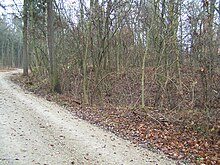
The Schwedenschanze is a small modern fortification on the summit of the Krahnberg on the western outskirts of the Thuringian district town of Gotha .
description
The Schwedenschanze is located about 200 m north of the Kriegberg - the name of which refers to its frequent use as an army camp. Right at the summit of the Krahnberg, on the western edge of today's Gotha district, is the Ratsholz . On its southern edge, ravines mark an old road that once formed a section of the Via Regia . Coming from Eisenach it ran via Mechterstädt to Neufrankenroda and climbed to the Krahnberg. East of the ski jump the descending path led over the Galberg to the western Gotha suburb with the Kreuzkloster . From the Schwedenschanze one also had a view of the country roads and trade routes running towards Gotha from the south and north.
history
The name "Schwedenschanze" recalls the time of the Thirty Years' War and has remained popular to this day. What is meant by this is a square rampart overgrown by trees and surrounded by a ditch, the last stage of which probably dates back to around 1640. It served as a camp fortification and probably also temporarily as a guard post for the city of Gotha.
Grumbachian Handel
The Gothaer Land has been Protestant since the Reformation. As early as the 16th century, Gotha was drawn into military conflicts known as Grumbach's Handel . When siege troops surrounded the city at the height of the conflict, the Krahnberg was also occupied by the imperial troops as an army camp in 1567.
Sweden time
The Gotha area was drawn into the fighting during the Thirty Years' War from 1630. First it is written about a sack of the country by the imperial army under Tilly , this was followed in 1631 by the passage of the Swedes after the victory of Gustav Adolf at Breitenfeld. The Swedes occupied parts of today's Thuringia and were also represented as garrisons in the cities of Erfurt, Eisenach and Gotha. In 1632 there was a big fire in Gotha as a result of the Swedish billeting. After the Swedes withdrew, the Gotha area recovered only slowly. From the beginning of May to August 1639, the officers and soldiers in the army of the Swedish General Johann Banner had to be fed by the city. In December 1640 Gotha was even designated as the headquarters of the Swedes for a few days.
Seven Years War
During the Seven Years' War some generals and senior officers quartered in Metebach. The more than 400 horses in the troop used up all their hay and oat supplies. The main armed forces of the Reich Execution Army under the leadership of the Duke of Saxony-Hildburghausen moved to the Krahnberg in autumn 1757, which was designated as a marching camp by the advancing coalition army of French and Reich troops. When scouts reported an approach by the enemy Prussians, the numerically superior but completely demoralized army fled in forced marches to the west, where they were forced to turn back before Eisenach. The legend of the Trügleber and Aspacher population tells that the French buried their war chest in the forest in the panic of the march.
Military training area
After the Second World War, the partially wooded area was seized by the Red Army as a military training area. A barracks settlement and an infantry firing range were created, this part of the Krahnberg became a restricted area and was no longer accessible to hikers.
literature
- Karl Kohlstock: Voyages of Discovery at Home. North-east side of the Galberg, Krahnberg . 2nd increased edition. Self-published, Gotha 1926, p. 18 (printed by Stollbergschen Buchdruckerei Gotha, issue 12).
- District office Gotha (ed.): The Krahnberg in the course of time . 1st edition. Gotha Druck, Gotha 1994, p. 48 .
Web links
Individual evidence
- ↑ a b c Katja Vogel, Thomas Huck: History of the Gothaer Land. Exhibition guide . Ed .: Gothaer Museum for Regional History. 1997, ISSN 0863-2421 , p. 31-33 . (as digitized version) ( Memento from July 19, 2011 in the Internet Archive ) (PDF file; 2.6 MB)
- ↑ Chronicle of the community of Aspach
Coordinates: 50 ° 57 '54.3 " N , 10 ° 39' 8.6" E
