Sengbach dam
| Sengbach dam | |||||
|---|---|---|---|---|---|
| Barrier wall of the Sengbach dam | |||||
|
|||||
|
|
|||||
| Coordinates | 51 ° 7 '44 " N , 7 ° 8' 1" E | ||||
| Data on the structure | |||||
| Lock type: | Arch weight wall | ||||
| Construction time: | 1900-1903 | ||||
| Height above foundation level : | 43 m | ||||
| Crown length: | 178 m | ||||
| Crown width: | 5 m | ||||
| Radius of curvature : | 150 m | ||||
| Data on the reservoir | |||||
| Altitude (at congestion destination ) | 148 m | ||||
| Water surface | 20 ha | ||||
| Reservoir length | 2.4 km | ||||
| Reservoir width | 100 to 180 m | ||||
| Storage space | 2.8 million m³ | ||||
| The water surface of the Sengbach dam | |||||
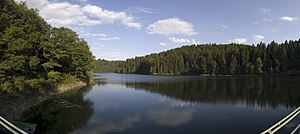
The Sengbach Dam is a water - dam in Solingen . It is located in a secluded side valley of the Wupper not far from Burg Castle , between the Solingen villages of Höhrath and Glüder . The water reservoir located between the forests supplies the residents of the city of Solingen with drinking water. For this reason, the building is usually only called "Solingen Dam" in the vernacular. At times it was also referred to as the "Senkbach-Thalsperre".
In order to treat the surface water in accordance with the Drinking Water Ordinance and make it available to all Solingen households, the water from the Sengbachtalsperre is transported via a pipe with a diameter of 900 mm to the nearby Glüder waterworks , where it is processed into drinking water in several stages using filters and modern process technology.
description
The Sengbachtalsperre is one of the oldest German drinking water reservoirs. The dam was built between 1900 and 1903 according to the Intze principle and consists of a main basin and a fore basin .
The successful pioneer of German dam construction was commissioned with the construction of the facility: Otto Intze . The barrage made of Lenneschiefer , greywacke and trass mortar was inaugurated on May 28, 1903.
The wall of the main basin measures 43 m from the base of the foundation, the top of the wall is 178 meters long. The width of the wall is 36.6 m at the bottom and 5 m at the top. The gravity dam with a radius of curvature of 150 m holds back around 2.8 million m³ of water when it is fully flooded . The maximum water depth is 36.0 m with a water surface of around 200,000 m².
The reservoir, which extends mainly in a north-west-south-east direction, is between 100 m and 180 m wide and has a length of approx. 2.4 km.
The barrier structure of the pre-barrier consists of a stone embankment dam with an internal concrete core. The pre-basin is operated in full water. The overflow height is 148 m above sea level. The storage volume is approx. 100,000 m³. The maximum water depth of the fore basin is 4.5 m. The forecourt serves as a sediment basin .
See also
literature
- Emil Mattern (hydraulic engineering inspector in Berlin): The water and electricity company of the city of Solingen: A dam and hydropower plant . In: Journal of Construction . Vol. 54 (1904), urn : nbn: de: kobv: 109-opus-90980 , pp. 295–346 (first part), urn : nbn: de: kobv: 109-opus-90993 , pp. 515–536 (second part) and urn : nbn: de: kobv: 109-opus-91007 , pp. 639–670 (third part). (Also images in the ZfB atlas of the year 1904, urn : nbn: de: kobv: 109-opus-91031 , pages 30–34.)
Web links
- The Sengbach dam on the private website of a Solinger


