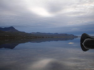
Skorradalsvatn
| Skorradalsvatn | ||
|---|---|---|

|
||
| The Skessuhorn mountain reflected in the Skorradalsvatn | ||
| Geographical location | Iceland | |
| Tributaries | Fitjaá, Dragá et al | |
| Drain | Andakilsá → Borgarfjörður | |
| Data | ||
| Coordinates | 64 ° 31 ′ N , 21 ° 28 ′ W | |
|
|
||
| surface | 14.7 km² | |
| length | 16 km | |
| width | 1 km | |
| Maximum depth | 48 m | |
The Skorradalsvatn is a lake in the west of Iceland . It is located in the municipality of Skorradalur .
Geography and history
It is located in a narrow valley between Hvalfjörður and Reykholtsdalur . Its length is almost 16 km, it is up to 1 km wide and has a total area of 14.7 km². The maximum depth is 48 m.
The mountains in the north of the lake reach a height of up to 450 m ( Skorradalsháls ). In the south of the lake there are higher mountains such as the Skarðsheiði (1053 m). The banks of the lake have been reforested.
In earlier times the route to Þingvellir passed Skorradalsvatn. This old path, which is still sometimes used for trekking today, crosses the mountains in the south-east towards Kaldidalur . The small Fitjaá river also flows into the lake there.
Today, Skorradalsvatn can mainly be reached via gravel roads. There are no places on its shores, but there are numerous weekend houses.
You can fish trout in the lake. The fauna of Skorradalsvatn was affected by partial damming, however, and fish died .
legend
An old legend tells of a snake that a peasant girl caught. But she escaped him and grew into a huge worm that is now said to live in the lake (see sea monsters ).
