Þingvellir
| Thingvellir National Park | ||
|---|---|---|
|
|
||
| Location: | Höfuðborgarsvæðið , Iceland | |
| Next city: | Reykjavík | |
| Surface: | 237 km² | |
| Founding: | 1928 | |
| Address: | Official website | |

Þingvellir ( ˈθiŋkvetlir , German also Thingvellir ) is a place and a national park in the southwest of Iceland , about 40 km east of the Icelandic capital Reykjavík on the north shore of the lake Þingvallavatn . The place Þingvellir has a special meaning for the history of Iceland. Located in a rift zone at the boundary between two tectonic plates, the area is also of geological importance.
Surname
Icelandic Þing means " Thing , people's assembly" (unlike the linguistically related English thing spoken with a g hardened to k ). Icelandic totalur means "field"; the plural vellir can also mean “level” and is pronounced “wettlir”. The place name is thus [θiŋkvetlir] meaning “level of the people's assembly”.
Historical meaning
At the time of settlement, riding trails from all parts of the country converged in Þingvellir. Here, on the Thingplatz near the Almannagjá Gorge , the traditional Althing assembly , which had both legislative and judicial functions, was held once a year for two weeks in June as early as 930, i.e. at the end of the conquest by mainly Norwegian Vikings . It is one of the oldest parliaments in the world - after those in Greece and the ancient Roman Empire . The Althing existed until 1798 when the Danes dissolved it.
In the year 1000 in Þingvellir the adoption of Christianity was decided.
The Republic of Iceland was proclaimed in this historic location on June 17, 1944 and its 50th anniversary in 1994.
Today, weathered and overgrown stone walls can still be seen on the edge of Parliament Square and in several places in the gorge - remnants of the storage facilities that were then covered with tarpaulin.
geology
Thingvellir is surrounded by a grave fault zone (western active rift zone) and is surrounded by four active volcanic systems, is under the influence of the whole area: the Hengill on the south shore of the lake Þingvallavatn and Hrómundartindur , Hrafnabjörg and Prestahnúkur .
At this place and in the wider area, the drifting apart of the American and Eurasian tectonic plates through imposing crevices and cracks becomes visible, especially at the Almannagjá (Allmann Gorge) or the Silfra Fissure . The tectonic shifts also frequently trigger earthquakes . In the last 10,000 years the land on both sides of the Almannagjá gorge has drifted apart by 70 meters and the valley floor has sunk by around 40 meters.
The Öxará river flows through the Þingvellir National Park and forms a remarkable waterfall, the Öxarárfoss , at the Almannagjá gorge .
Tourist importance
Together with the Gullfoss waterfall and the geysers of the Haukadalur , Þingvellir is one of the most famous sights in Iceland, the so-called Golden Circle .
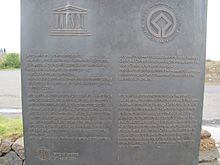
For the 1000th anniversary of the Althing, Þingvellir was declared a national park in 1930 . In 2004 the national park was added to the list of world cultural heritage by UNESCO .
In the national park, the Hotel Valhöll has stood by the last bridge over the Öxará since 1898. It was renovated for the 1000th anniversary of Iceland and was state-owned. In a fire in July 2009, it was so badly damaged that it could not be rebuilt.
On March 31, 2011, a small hole formed in the gravel path that leads through the Allmann Gorge . No people were harmed. A crevice about 10 meters deep was then discovered under the path. The affected part of the path has been replaced by a wooden bridge.
The Silfragjá has developed into an extraordinary dive site . Here you can dive in a gorge east of the mouth of the Öxará, directly between the North American and Eurasian continental plates.
swell
- Brochure: Welcome to Þingvellir published by Þingvellir National Park Administration
See also
Web links
- Entry on the UNESCO World Heritage Center website ( English and French ).
- Geology of the Thingvellir area
- The old parliament building in Þingvellir
- Program “Treasures of the World” on SWR: Thingvellir National Park - The Viking Parliament
Individual evidence
- ↑ Þingvellir National Park Management Plan 2004 to 2024
- ↑ cf. Thor Thordarson, Armann Hoskuldsson: Classic Geology in Europe 3. Iceland. Harpenden 2002, p. 74 ff.
- ↑ cf. Earthquakes - Iceland . hraun.vedur.is. Retrieved May 11, 2011.
- ↑ The historic hotel in Thingvellir burned down. Retrieved September 14, 2019 .


