Snapper Island (Queensland)
| Snapper Island | ||
|---|---|---|
| Snapper Island off the mouth of the Daintree Rier | ||
| Waters | Coral sea | |
| Archipelago | Snapper Island and Hope Islands | |
| Geographical location | 16 ° 17 '53 " S , 145 ° 29' 57" E | |
|
|
||
| length | 2.1 km | |
| width | 600 m | |
| surface | 66 ha | |
| Highest elevation | 99 m | |
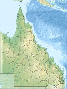
Snapper Island is an island in the northeast of the Australian state of Queensland , about 70 km south of Cooktown and about 21 km north of Mossman before the mouth of the Daintree River . The island is part of the Hope Islands National Park , which also includes the two Hope Islands , two small coral islands , about 50 km north of Snapper Island .
history
The island belongs to the traditional distribution area of the Aboriginal tribe of the Kuku Yalanji , who still hunt on the island and fish in the surrounding waters. At the beginning of the 20th century a lime kiln was operated on the island and it is believed that sea cucumbers were also processed. The stony stream bed of a Chinese market garden can still be seen on the island today.
National nature
Snapper Island, a rocky island on the continental shelf with a length of approx. 2 km and a width of approx. 180-500 m, rises up to 99 m from the sea and is surrounded by a coral reef . It is part of the Great Barrier Reef World Heritage Site .
Flora and fauna
The island has dense rain and hard deciduous forests in its interior and a small mangrove deposit . Typical coastal vegetation surrounds the island.
All types of forest and sea birds can be found on Snapper Island. In the summer months two-colored fruit pigeons live there, which feed on the forests of the nearby mainland.
Facilities
Wildlife camping is only permitted at West Point , but there are no special facilities. There is a picnic area with tables and a toilet on the southwest side of the island. From there, a short hiking trail leads over a rocky ridge to the north side of the island. The interior of the island should, if possible, not be entered to protect the vegetation.
Driveway
The island can only be reached by private boats and only in good weather from the northwest side. In addition, it is also used by commercial providers.
Individual evidence
- ^ Steve Parish: Australian Touring Atlas . Steve Parish Publishing. Archerfield QLD 2007. ISBN 978-1-74193-232-4 . P. 14
- ↑ a b c d e f Snapper Island in Hope Islands National Park . Department of Environment and Resource Management. Retrieved December 13, 2012.
- ↑ About Snapper Island (accessed February 21, 2018)

