Sobo Katamuki Quasi National Park
|
Sobo Katamuki Quasi National Park
|
||
| location | Ōita and Miyazaki Prefectures , Japan | |
| WDPA ID | 3276 | |
| Geographical location | 32 ° 44 ' N , 131 ° 25' E | |
|
|
||
| Setup date | March 25, 1965 | |
| administration | Oita Prefecture , Miyazaki Prefecture | |
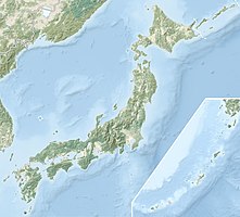
The Sobo Katamuki Quasi National Park ( Japanese 祖母 傾 国 定 公園 Sobo Katamuki Kokutei Kōen ) is one of more than 50 quasi national parks in the north of Kyūshū in Japan. The Ōita and Miyazaki prefectures are responsible for managing the park. The park area covers an area of approx. 270 km², of which 100.24 km² is in Ōita. With the IUCN Category V, the park area is classified as a Protected Landscape / Protected Marine Area . In the park is also the eponymous 1756 m high mountain Sobo-san, which houses mineral ores such as copper, tin, lead and manganese, as well as rock crystals. The mining of the mineral ores took place from the Edo period to the middle of the Shōwa period . The Obira tin mine was an important source of raw materials in Japan until it ceased operations in 1954.
The park is also the habitat of the Japanese serau , the Japanese macaque , the Feuerliest and the white-backed woodpecker . There are also several hot springs ( onsen ) in the park.
See also
Web links
World Database on Protected Areas - Sobo Katamuki-Quasi-National Park (English)
- 祖母 傾 国 定 公園 . Miyazaki Prefecture,accessed December 20, 2019(Japanese, Illustrated with flora and fauna).
Individual evidence
- ↑ 祖母 傾 国 定 公園 . In: ブ リ タ ニ カ 国際 大 百科 事 典 小 項目 事 典 et alii at kotobank.jp. Retrieved December 20, 2019 (Japanese).

