
Solar eclipse of October 23, 2014
| Solar eclipse of October 23, 2014 | |
|---|---|
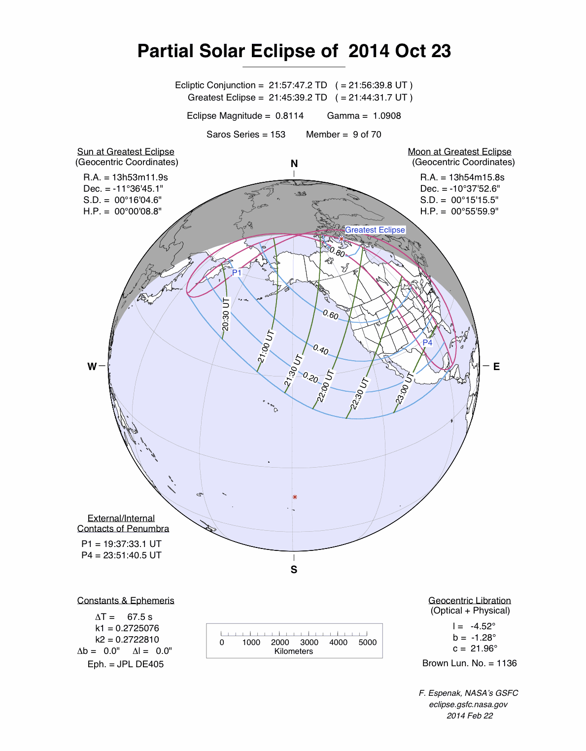
 Course of the penumbra on the earth's surface |
|
| classification | |
| Type | Partially |
| area | North America |
| Saros cycle | 153 (9 of 70) |
| Gamma value | +1.0909 |
| Greatest eclipse | |
| place | Canada : Franklin Strait, south of Prince of Wales Island (Nunavut) |
| location | 71 ° 12 ′ N , 97 ° 12 ′ W |
| time | October 23, 2014 21:44:28 UT |
| size | 0.8108 |
The solar eclipse of October 23, 2014 was a purely partial eclipse , so the earth was only hit by the penumbra of the moon. The visibility area spanned almost all of North America. However, the sun went down in the east of the continent during the course of the eclipse. The visibility conditions were much better on the North American Pacific coast , where the eclipse took place during the afternoon. In the far east of Russia , the solar eclipse was observed during sunrise .

The solar eclipse - seen in Minneapolis
Web links
Commons : Solar eclipse of October 23, 2014 - Collection of images, videos and audio files
|
Previous solar eclipses:
|
Later solar eclipses:
|
|||||||||
|
May 20, 2012 (circular) |
November 13, 2012 (total) |
May 10, 2013 (circular) |
November 3, 2013 (hybrid) |
April 29, 2014 (circular) |
October 23, 2014 (partial) |
March 20, 2015 (total) |
September 13, 2015 (partial) |
March 9, 2016 (total) |
September 1, 2016 (circular) |
February 26, 2017 (ring-shaped) |
|
|
|
|
|
|
|
|
|
|
|
|
| Lists: 20th century • 21st century • All lists | ||||||||||