Southern Indian Lake
| Southern Indian Lake | |||||||||
|---|---|---|---|---|---|---|---|---|---|
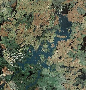
| Satellite image | |||||||||
|
|||||||||
|
|
|||||||||
| Coordinates | 57 ° 19 '26 " N , 98 ° 22' 27" W | ||||||||
| Data on the structure | |||||||||
| Construction time: | 1973-1977 | ||||||||
| Operator: | Manitoba Hydro | ||||||||
| Data on the reservoir | |||||||||
| Altitude (at congestion destination ) | 258 m | ||||||||
| Water surface | 2 015 km² | ||||||||
| Reservoir length | 155 km | ||||||||
| Catchment area | 260 000 km² | ||||||||
| flow regulated | |||||||||
The Southern Indian Lake (English for "southern Indian lake") is a lake in the Canadian province of Manitoba , about 300 km west of Hudson Bay .
The Southern Indian Lake forms a 2015 km² water surface (total area with islands: 2247 km²) on the middle course of the Churchill River . Upper current is the Opachuanau Lake , The effluent Partridge Breast Lake . Below the Southern Indian Lake, the Churchill River flows 460 km to its confluence with Hudson Bay. The heavily indented 155 km long lake lies at an altitude of 258 m in the area of the Canadian Shield . The catchment area covers around 260,000 km². The Cree settlement of South Indian Lake is on the south shore of the lake.
Churchill River Diversion
In the mid-1960s, the first studies were carried out that provided a discharge of part of the river water of the Churchill River south to the Nelson River . The planners expected a more economical use of its hydropower. Between 1973 and 1977 a drainage control structure was built at Missy Falls on the natural runoff of Southern Indian Lake, south and north of the Patterson Island river island . This increases the water level of the lake by 3 m and regulates the flow of the lake into the lower reaches of the Churchill River. A damming of up to 10.6 m was originally planned. At the same time, a 4 km long and on average 150 m wide drainage channel , the South Bay Diversion Channel , was dredged on the south bank of South Bay . Since 1977, a large part of the water has flowed through this into the river system of the Rat River, which runs south . Its discharge into the Burntwood River , a tributary of the Nelson River, which is even further south , is regulated by a weir at Notigi . The state requirements for the operator of the project see u. a. suggest that a maximum of 850 m³ / s are diverted. In addition, at least 14 m³ / s during the ice-free period and 43 m³ / s during the rest of the year must be discharged into the lower reaches of the Churchill River. The original discharge into the lower reaches of the Churchill River fluctuated between 566 m³ / s and 1982 m³ / s and averaged 991 m³ / s. After the project was implemented, the mean discharge was reduced to 227 m³ / s.
Web links
- Southern Indian Lake at Natural Resources Canada

