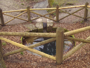
Spittelbrunnen
| Spittelbrunnen | |||
|---|---|---|---|
 Pouring Spittelbrunnen |
|||
| location | |||
| Country or region | Unstrut-Hainich district ( Thuringia ) | ||
| Coordinates | 51 ° 10 ′ 50 " N , 10 ° 23 ′ 12" E | ||
|
|||
| geology | |||
| Mountains | Hainich | ||
| Source type | Karst spring | ||
| Hydrology | |||
| River system | Elbe | ||
| Receiving waters | Spittelgraben → Felchtaer Bach → Unstrut → Saale → Elbe → North Sea | ||
Coordinates: 51 ° 10 ′ 50 ″ N , 10 ° 23 ′ 12 ″ E
The Spittelbrunnen is a hunger well , i.e. a karst spring that periodically carries water , in the north of the Hainich near Mühlhausen in Thuringia .
description
The Spittelbrunnen, which only pours after long rainstorms , is located in the Mühlhausen city forest southwest of the city center and is lined with shell limestone blocks. The spring inlet has a diameter of about one and a half meters and is about two meters deep. The fountain takes its name from the former village of Spudelborn, which was abandoned in the 13th century. The draining Spittelgraben runs to the east and merges into the Felchtaer Bach at Weidensee , a tributary of the Unstrut .
See also
Web links
Commons : Spittelbrunnen - collection of images, videos and audio files

