
Gar Qu
| Gar Qu | ||
.jpg) The headwaters of the Yangtze River, in the middle of the Gar Qu |
||
| Data | ||
| location | Greater community Dangla , Golmud Autonomous District Haixi , Qinghai ( China ) | |
| River system | Yangtze River | |
| Drain over | Bu Qu → Dam Chu → Yangtze River → East China Sea | |
| origin | Glacier east of the source of Tuotuo He 33 ° 19 ′ 35 ″ N , 91 ° 14 ′ 26 ″ E |
|
| muzzle |
Bu Qu coordinates: 33 ° 52 '2 " N , 92 ° 22' 11" E 33 ° 52 '2 " N , 92 ° 22' 11" E
|
|
| length | 162 km | |
| Catchment area | 4120 km² | |
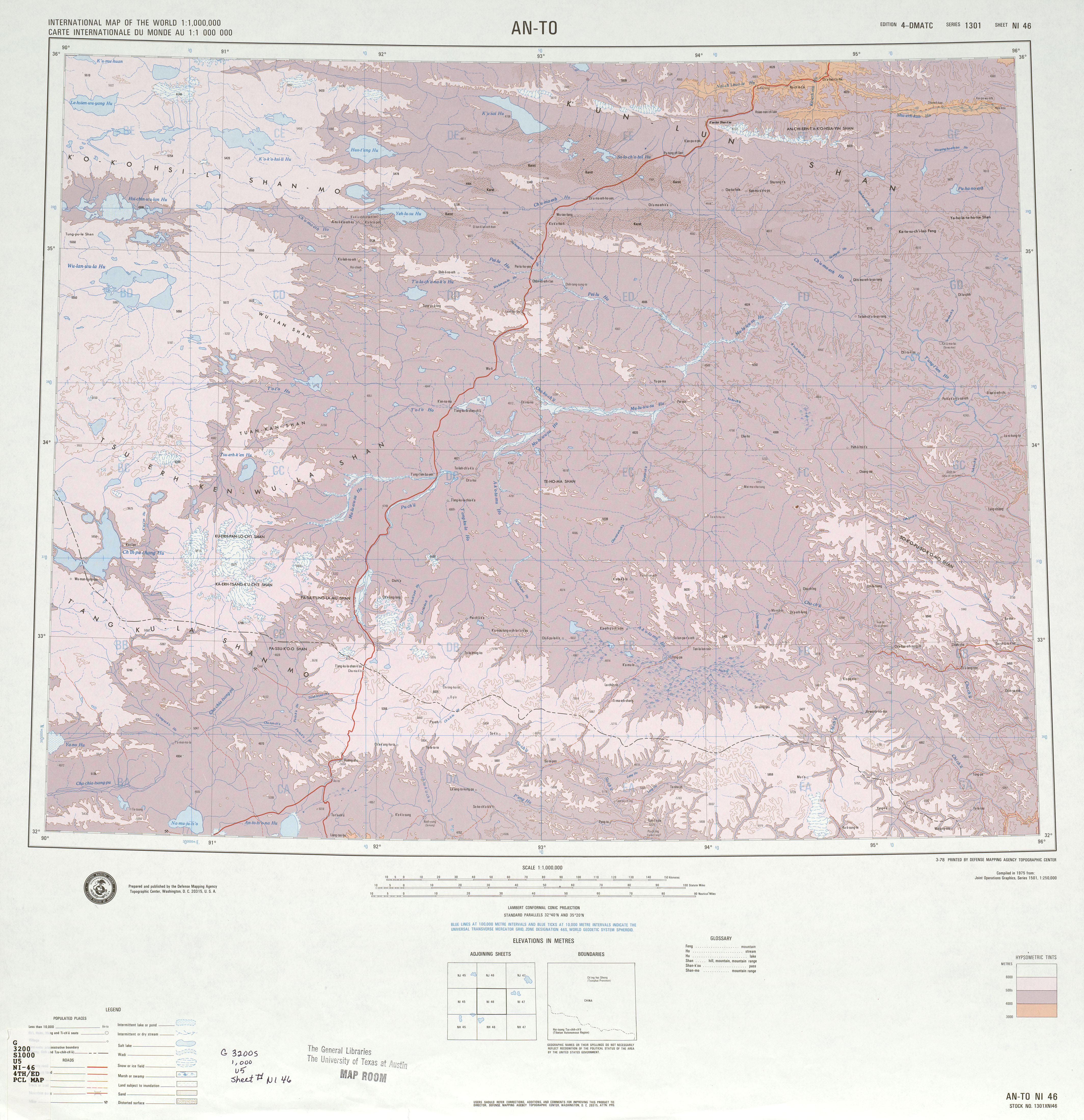
The Gar Qu ( Chinese 尕 尔 曲 , Pinyin Gǎ'ěr Qu ) is a river in the headwaters of the Yangtze River in the Chinese province of Qinghai . It is 162 km long and drains an area of 4120 km².
course
It rises from a glacier not far from the source of the Tuotuo He , one of the source rivers of the Yangtze River, flows largely to the northeast and flows from the left into the Bu Qu ( 布 曲 , Pu-ch'ü ), which shortly afterwards into the Dam Chu , another source river of the Yangtze River, flows into it. The Qingzang Railway and the G109 national road cross the river immediately above the estuary . The entire course of the river lies in the large municipality of Dangla, which belongs to the urban Golmud in the Haixi autonomous district of the Mongols and Tibetans .
Mörön Us
The Gar Qu has only recently been considered a tributary of the Bu Qu. Before it was considered the upper course of a river called Mörön Us ( Chinese 木 鲁乌苏 河 , Pinyin Muluwusu He , Cyrillic Маруй-Ус (Maruj-Us) or Дечу (Deču) ), which flows into the Ulaan Mörön (kyr. Улан-Мурэн (Ulan-Murèn) ) after the absorption of the Bu Qu and the Dam Chu , which consists of the Tuotuo He and the upper reaches of the Tongtian He up to the confluence of the Chumar . On other maps, the Mu-lu-wu-su Ho continues to the Chumar, and the Tuotuo He is already called T'o-t'o Ho.
For others, the confluence of Gar Qu and Bu Qu was considered the beginning of the Tongtian He, which is why the town of Garquyan ( 尕 尔 曲 沿 , 33 ° 52 ′ 41.5 ″ N , 92 ° 20 ′ 55) , located between the railway and road bridges , 5 ″ O ) until 1976 was called Tongtianheyan ( 通天河 沿 ), a name that is still used today (2011) on Google Maps .
Individual evidence
- ↑ a b Bertelsmann House Atlas. Bertelsmann Verlag, Gütersloh 1960
- ↑ a b Soviet General Staff Map, sheet I 46, accessed from http://www.topomapper.com/
- ↑ US Army Map Service: International Map of the World , sheet NI 46 "An-to"