Qinghai
| Abbreviation : 青 ( Pinyin : Qīng) | |
| Capital | Xining |
|
surface - Total |
Rank 4 of 33 721,000 km² |
|
population
- Total 2016 |
Rank 31 out of 33
5,930,000 inhabitants |
| Management type | province |
| governor | Liu Ning |
| ISO-3166-2 code | CN-QH |
| District level | 6 autonomous districts, 2 cities |
| District level | 26 counties, 7 autonomous counties, 7 city districts, 4 cities |
| Community level | 200 parishes, 138 large parishes, 30 street districts, 28 nationality parishes |
| Tibetan name |
|---|
|
Tibetan script :
མཚོ་ སྔོན་ ཞིང་ ཆེན
|
|
Wylie transliteration : mtsho sngon zhing chen
|
| Chinese name |
|
Simplified : 青海省
|
|
Pinyin : Qīnghǎi Shěng
|
Qinghai ( Chinese 青海 , Pinyin Qīnghǎi - "turquoise blue sea", Tib. མཚོ་ སྔོན་ ཞིང་ ཆེན Wylie mtsho sngon zhing chen ) is a province of the People's Republic of China in the northeast of the Tibetan highlands. Their area covers or partially overlaps with Amdo, which is part of the Tibetan cultural area .
geography
Qinghai borders the provinces of Xinjiang , Gansu , Sichuan and Tibet .
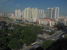
The capital of Qinghai is Xining , it is also the only megacity in the province. The second largest city, Golmud , has just over 270,000 inhabitants. Over half of the terrain is at an altitude of 4,000 to 5,000 meters. Agriculture is possible up to an altitude of 3200 meters. In the province lies the northeast part of the Chang Tang , the Tibetan plateau. The desert-like Qaidam basin is also located here .
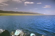
The Qinghai Lake located here is the largest salt lake in China and supplies not only salt but also phosphates; there are also mineral resources in the form of oil, coal and iron ore. The Huang He (Yellow River) flows to the east of Qinghai , where the majority of the population lives. The Yangzi also has its source in Qinghai. The climate is continental: arid and cold with long winters and short summers.
The capital Xining has been the gateway to Tibet and Central Asia for many centuries .
history
Since the end of the Greater Tibetan Empire, headed by the Tsenpos ( btsan po ), an emperor-like ruler, there was no longer any unified Tibet on the entire Tibetan highlands. Eastern Tibet in particular consisted of a large number of small and medium-sized empires and regions, some of which were subordinate to the Lhasa government of the later Dalai Lamas , some of which were Chinese provinces, and some of which were largely independent. From around 1727, the north of Kham , known as the Kukunor Territory , and most of Amdo were administered from Xining , a city that was subordinate to Gansu Province until the early 20th century .
Today's Qinghai Province emerged from this administrative area in 1928, the majority of which was ruled by Gansu-born Muslim-Chinese Hui governors and warlords ( Xibei San Ma ) instead of the government of the Chinese Republic or the Tibetan government in Lhasa from 1912 to 1949 has been.
The Hui Muslims had risen against the Chinese central government as early as 1781–84, and in 1807 there was a revolt of the Tibetan tribes. The last Muslim uprising in the region was suppressed by the authorities in October 1993. In 2008, Tibetan riots briefly spread to Qinghai.
On April 14, 2010, the region was hit by a 7.1 magnitude earthquake that killed at least 400 people, injured 8,000 and left many more homeless.
Administrative structure
Qinghai Province consists of a prefecture city , a government district and six autonomous districts.
Autonomous districts and autonomous districts for national minorities actually extend over the entire area of the province. A good 97% of Qinghais are Tibetan autonomous areas compared to just two percent for the Hui. However, the Tibetans share by far the largest Autonomous District (Haixi) with the Mongols, and there are more Hui than Tibetans in the Haibei Autonomous District.
| District level | District level | ||||
|---|---|---|---|---|---|
| Surname | Tibetan | Wylie | Abbreviation | Pinyin | |
|
City of Xining ཟི་ ལིང་ ཁྱེར་ zi ling khyer 西宁 市 Xīníng Shì 7,472 km² approx. 1.79 million inhabitants (2004) |
Chengzhong District | 城中 区 | Chéngzhōng Qū | ||
| Chengdong District | 城东 区 | Chéngdōng Qū | |||
| Chengxi District | 城西 区 | Chéngxī Qū | |||
| Chengbei District | 城北区 | Chéngběi Qū | |||
| District Huang Yuan | སྟོང་ སྐོར་ རྫོང ། | stong skor rdzong | 湟源县 | Huángyuán Xiàn | |
| Huangzhong County | རུ་ ཤར་ རྫོང ། | ru shar rdzong | 湟 中 县 | Huángzhōng Xiàn | |
| Autonomous County Datong the Hui | གསེར་ ཁོག ། | gser khog | 大通 回族 土族 自治县 | Dàtōng Huízú Tǔzú Zìzhìxiàn | |
|
Haidong City མཚོ་ ཤར་ ས་ ཁུལ ། mtsho shar sa khul 海东 市 Hǎidōng Shì 13,161 km² approx. 1.48 million inhabitants (2004) |
Ledu District (Zhocang) | གྲོ་ ཚང་ རྫོང ། | gro tshang rdzong | 乐 都 区 | Lèdū Qū |
| Ping'an District | 平安 区 | Píng'ān Qū | |||
| Hui and Tu Minhe Autonomous County | བཀའ་ མ་ ལོག ། | bka 'ma lied | 民和 回族 土族 自治县 | Mínhé Huízú Tǔzú Zìzhìxiàn | |
| Huzhu der Tu Autonomous County | དགོན་ ལུང ། | dgon lung | 互助 土族 自治县 | Hùzhù Tǔzú Zìzhìxiàn | |
| Hualong Hui Autonomous County | བ་ ཡན ། | ba yan | 化 隆 回族 自治县 | Huàlóng Huízú Zìzhìxiàn | |
| Xunhua Autonomous County the Salar | ཡ་ རྫི ། | ya rdzi | 循化 撒拉族 自治县 | Xúnhuà Sālāzú Zìzhìxiàn | |
|
Haibei Autonomous District of Tibetans མཚོ་ བྱང་ བོད་ རིགས་ རང་སྐྱོང་ ཁུལ ། mtsho byang bod rigs rang skyong khul 海北 藏族 自治州 Hǎiběi Zàngzú zìzhìzhōu 39,354 km² approx. 270,000 inhabitants (2004) |
Haiyan County | མདའ་ བཞི་ རྫོང ། | mda 'bzhi rdzong | 海晏 县 | Hǎiyàn Xiàn |
| Qilian County | ཆི་ ལེན་ རྫོང ། | chi len rdzong | 祁连 县 | Qílián Xiàn | |
| Gangca district | རྐང་ ཚ་ རྫོང ། | rkang tsha rdzong | 刚察 县 | Gāngchá Xiàn | |
| Menyuan Hui Autonomous County |
མོང་ ཡོན་ ཧུའ ེ་ རིགས་ རང་སྐྱོང་ རྫོང ། |
mong yon hu'e rigs rang skyong rdzong |
门 源 回族 自治县 | Ményuán Huízú Zìzhìxiàn | |
|
Haixi Autonomous District of the Mongols and Tibetans མཚོ་ ནུབ་ སོག་ རིགས་ ཆ་ བོད་ རིགས་ རང་སྐྱོང་ ཁུལ ། mtsho nub sog rigs dang bod rigs rang skyong khul 海西 蒙古族 藏族 自治州 Hǎixī Měnggǔzú Zàngzú Zìzhìzhōu 116,175 km² approx. 140,000 inhabitants |
Delhi city | གཏེར་ ལེན་ ཁ ། | gter len kha | 德令哈 市 | Délìnghā Shì |
| City of Golmud | གོར་ མོ ། | gor mo | 格尔木 市 | Gé'ěrmù Shì | |
| District of Ulan | ཝུ་ ལཱན་ རྫོང ། | wu lān rdzong | 乌兰 县 | Wūlán Xiàn | |
| Dulan County |
ཏུའ ུ་ ལན་ རྫོང ། པཎ་ ཆེན་ ཞིང་ སྡེ་ རྫོང ། |
tu'u lan rdzong paNa chen zhing sde dzong |
都 兰 县 | Dūlán Xiàn | |
| Têmqên district | ཐེམ་ ཆེན་ རྫོང ། | them chen rdzong | 天 峻 县 | Tiānjùn Xiàn | |
| Lenghu Administrative Committee | ལེང་ ཧུའ ུ ། | leng hu'u | 冷 湖 行政 委员会 | Lěnghú Xíngzhèng Wěiyuánhuì | |
| Da Qaidam Administrative Committee | ཚྭ་ འདམ་ ཆེན ། | tshwa 'dam chen | 大 柴 旦 行政 委员会 | Dàcháidàn Xíngzhèng Wěiyuánhuì | |
| Mangnai Management Committee | མང་ ནའེ ། | mang na'e | 茫崖 行政 委员会 | Mángyá Xíngzhèng Wěiyuánhuì | |
|
Hainan Autonomous District of Tibetans མཚོ་ ལྷོ་ བོད་ རིགས་ རང་སྐྱོང་ ཁུལ ། mtsho lho bod rigs rang skyong khul 海南 藏族 自治州 Hǎinán Zàngzú zìzhìzhōu 45,895 km² approx. 390,000 inhabitants (2004) |
Gonghe County | ཆབ་ ཆ་ རྫོང ། | chab cha rdzong | 共和 县 | Gònghé Xiàn |
| district Tongde | གད་ པ་ སུམ་ མདོ་ རྫོང ། | gad pa sum mdo rdzong | 同德 县 | Tongdé Xiàn | |
| Circle guide | ཁྲི་ ག་ རྫོང ། | khri ga rdzong | 贵德 县 | Guìdé Xiàn | |
| Xinghai County | རྩི་ གོར་ ཐང་ རྫོང ། | tsi gor thang rdzong | 兴 海 县 | Xìnghǎi Xiàn | |
| Guinan County | མང་ ར་ རྫོང ། | mang ra rdzong | 贵 南县 | Guìnán Xiàn | |
|
Autonomous District Huangnan Tibetan རྨ་ ལྷོ་ བོད་ རིགས་ རང་སྐྱོང་ ཁུལ ་. rma lho bod rigs rang skyong khul 黄 南 藏族 自治州 Huángnán Zàngzú Zìzhìzhōu 17,921 km² approx. 210,000 inhabitants (2004) |
Tongren County | རེབ་ གོང་ རྫོང ། | reb gong rdzong | 同仁 县 | Tóngrén Xiàn |
| circle Jainca county | གཅན་ ཚ་ རྫོང ། | gcan tsha rdzong | 尖扎 县 | Jiānzā Xiàn | |
| Zêkog district | རྩེ་ ཁོག་ རྫོང ། | rtse khog rdzong | 泽库 县 | Zékù Xiàn | |
| Henan Autonomous County of the Mongols | ཡུལ་ རྒན་ ཉིན ། | yul rgan nyin | 河南 蒙古族 自治县 | Hénán Měnggǔzú Zìzhìxiàn | |
|
Golog Autonomous District of Tibetans མགོ་ ལོག་ བོད་ རིགས་ རང་སྐྱོང་ ཁུལ ། mgo log bod rigs rang skyong khul 果洛 藏族 自治州 Guǒluò Zàngzú zìzhìzhōu 76,312 km² approx. 130,000 inhabitants (2004) |
Maqên County | རྨ་ ཆེན་ རྫོང ། | rma chen rdzong | 玛沁 县 | Mǎqìn Xiàn |
| Baima County | པད་ མ་ རྫོང ། | pad ma rdzong | 班 玛 县 | Bānmǎ Xiàn | |
| Gadê district | དགའ་ བདེ་ རྫོང ། | dga 'bde rdzong | 甘德 县 | Gāndé Xiàn | |
| Darlêg County | དར་ ལག་ རྫོང ། | there lay rdzong | 达 日 县 | Dárì Xiàn | |
| Jigzhi County | གཅིག་སྒྲིལ་ རྫོང ། | gcig sgril rdzong | 久 治 县 | Jiǔzhì Xiàn | |
| Madoi County | རྨ་ སྟོད་ རྫོང ། | rma stod rdzong | 玛多 县 | Mǎduō Xiàn | |
|
Autonomous Prefecture of Yushu Tibetan ཡུས་ ཧྲུའུ་ བོད་ རིགས་ རང་སྐྱོང་ ཁུལ ་. yus hru'u bod rigs rang skyong khul 玉树 藏族 自治州 Yùshù Zàngzú zìzhìzhōu 188,794 km² approx. 260,000 inhabitants (2004) |
Yushu City | སྐྱེ་ རྒུ་ མདོ་ རྫོང ། | skye rgu mdo rdzong | 玉树 市 | Yùshù Shì |
| Zadoi district | རྫ་ སྟོད་ རྫོང ། | rdza stod rdzong | 杂 多 县 | Záduō Xiàn | |
| circle Chidu | ཁྲི་ འདུ་ རྫོང ། | khri 'du rdzong | 称 多 县 | Chènduō Xiàn | |
| Zhidoi County | འབྲི་ སྟོད་ རྫོང ། | 'bri stod rdzong | 治 多 县 | Zhìduō Xiàn | |
| Nangqên County | ནང་ ཆེན་ རྫོང ། | nang chen rdzong | 囊 谦 县 | Nángqiān Xiàn | |
| Qumarlêb County | ཆུ་ དམར་ ལེབ་ རྫོང ། | chu dmar leb rdzong | 曲 麻 莱 县 | Qǔmálái Xiàn | |
population
Population development
Population growth in the province since 1954.
| year | population |
|---|---|
| 1954 census | 1,676,534 |
| 1964 census | 2,145,604 |
| 1982 census | 3,895,706 |
| 1990 census | 4,456,952 |
| 2000 census | 4,822,963 |
| 2010 census | 5,626,723 |
| Guess 2016 | 5,930,000 |
ethnicities
The population is multi-ethnic: the mountainous west is populated by nomads. A good half of the population consists of Han (54.5%), the rest are Tibetans (20.8%), Hui (16%), Mongols , Salar , Tu and Dongxiang . The ethnic groups speaking Tibetan dialects do not call themselves Böpa ( bod pa ), as the Tibetan term for Tibetans is, but Amdowa ( a mdo pa ) and Khampa ( khams pa ).
Religions
Most of the Tu and many Mongols are Lamaist Buddhists like the Tibetans. Hui, Salar and Dongxiang are predominantly Muslim.
economy
Migratory livestock farming (yaks, sheep, cashmere goats, horses) is still predominant among Tibetans and Mongols on the Tibet-Qinghai Plateau, the plateau that extends to Tibet in the south. In the north-east of the province, sedentary agriculture dominates, especially among the Qinghai Islamic peoples (Hui, Dongxiang, Salar). But partly also with the Tibetan Buddhist Tu (Mongour).
Sports
In 2009 the World Climbing Championships took place in Qinghai .
The province as namesake
The asteroid (2255) Qinghai , discovered on November 3, 1977, has been named for the province since 1981.
literature
- Amnye Make Institute : རྒྱ་ དམར་ གྱི་ བཙན་ འོག་ཏུ་ གནས་ པའི་ བོད་ དང་ ས་ འབྲེལ་ ཁག་ གི་ ས་ ཁྲ ། Wylie Rgya dmar gyi btsan 'og tu gnas pa'i bod dang sa' brel khag gi sa khra - Tibet and Adjacent Areas under Communist China's Occupation - 1: 3,200,000 , Dharamsala 1998, ISBN 978-81-86227-16-9 .
- Andreas Gruschke: Demography and Ethnography in the Highlands of Tibet , in: Geographische Rundschau, 49 (1997), Issue 5, pp. 279–286.
- Andreas Gruschke: The Cultural Monuments of Tibet's Outer Provinces: Amdo , White Lotus Press, Bangkok 2001, 2 volumes: The Qinghai part of Amdo , ISBN 978-974-7534-59-7 ; The Gansu and Sichuan parts of Amdo , ISBN 978-974-7534-90-0 .
- Gyurme Dorje: Footprint Tibet Handbook , 4th ed., Footprint, Bath 2009, ISBN 978-1-906098-32-2 .
Web links
Individual evidence
- ↑ Jeremy Black (Ed.): DK Atlas of World History . Starnberg 2006, p. 275.
- ↑ Earthquake in Northwest China - Around 300 people lose their lives. In: n24 .de. January 1, 1999, accessed April 14, 2010 .
- ↑ China: Provinces and Major Cities - Population Statistics, Maps, Charts, Weather, and Web Information. In: www.citypopulation.de. Retrieved May 7, 2018 .
- ↑ Minor Planet Circ. 6059. ( PDF file; 172 kB) In: www.minorplanetcenter.net. June 1, 1981, accessed May 7, 2018 .
Coordinates: 35 ° 49 ' N , 96 ° 17' E


