
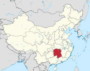
Hunan
| Abbreviation : 湘 ( Pinyin : Xiāng) | |
| Capital | Changsha |
|
surface - Total |
Rank 10 out of 33 210,800 km² |
|
population
- Total 2016 |
Rank 7 out of 33
68,220,000 inhabitants |
| Management type | province |
| governor | Xu Dazhe |
 .svg) |
|
| ISO-3166-2 code | CN-HN |
| District level | 13 cities, 1 autonomous district |
| District level | 60 counties, 36 city districts, 18 cities, 7 autonomous counties |
| Community level | 1,089 large communities, 990 communities, 233 street districts, 97 nationality communities |
Hunan ( Chinese 湖南省 , Pinyin Hunan , dt. "South of the lake") is a since the empire existing Province in the People's Republic of China .
The name of the province comes from the fact that Hunan is located south of Dongting Lake ( 湖 , hú - "lake"; 南 , nán - "south"). It has played an important role in the country's rice supply since the Yuan and Ming dynasties , when Hunan and Hubei were combined in the province of Huguang ( 湖廣 , húgu Provinzng ). Hunan is one of the most fertile and best irrigated provinces in China. In addition to rice, the production of tea and cotton also plays an important role.
Population development
Population growth in the province since 1954.
| year | population |
|---|---|
| 1954 census | 33.226.954 |
| 1964 census | 37.182.286 |
| 1982 census | 54.008.851 |
| 1990 census | 60,659,754 |
| 2000 census | 63.274.173 |
| 2010 census | 65,700,762 |
| Guess 2016 | 68,220,000 |
Geographical location
Hunan is located on the middle reaches of the Yangtze . In the south, Hunan is the Nan Ling called Mountain of Guangdong limited. The province bears its name due to its location south of the lake region on the border with Hubei along the Yangtze River. Except in the northeast, Hunan is criss-crossed by low mountain ranges and thus breaks up into several singular basins . About in the center of the province is the Heng Shan , the southernmost of the former five sacred mountains of China .
Neighboring provinces are Guangdong , Guangxi (autonomous region), Guizhou , Chongqing , Hubei and Jiangxi (clockwise).
Rivers

The largest rivers all flow towards the Yangtze. The Xiang Jiang rises in Guangxi and reaches below Quanzhou to Hunan, the Luihe flows to the right of this and the Zejiang to the left. The Yuánjiāng and the Li Shui have their source in Guizhou . All three rivers flow into the Dongting Lake basin in the northeast of the province. This over 5,500 km² lake is only so big during the great floods of the Yangtze River in summer, at other times of the year it only consists of the three mentioned rivers and a few smaller rivers.
Administrative structure
Hunan Province is made up of 13 prefecture-level cities and one autonomous district.
- Changsha City (长沙 市);
- Zhuzhou City (株洲 市);
- Xiangtan City (湘潭 市);
- Hengyang City (衡阳 市);
- City Shaoyang (邵阳市);
- Yueyang City (岳阳 市);
- Changde City (常德 市);
- Zhangjiajie City (张家界 市);
- Yiyang City (益阳 市);
- Chenzhou City (郴州 市);
- Yongzhou City (永 州市);
- Huaihua City (怀化 市);
- City of Loudi (娄底 市);
- Xiangxi Autonomous District of Tujia and Miao (湘西 土家族 苗族 自治州).
The capital of the province is Changsha .
Biggest cities
The population figures are based on the 2010 census and refer to the actual urban settlement. In 2014, 49.3% of the population lived in cities or urban areas.
| rank | city | Residents | rank | city | Residents |
|---|---|---|---|---|---|
| 1 | Changsha | 3,193,354 | 6th | Changde | 846.308 |
| 2 | Hengyang | 1,115,645 | 7th | Yiyang | 697,607 |
| 3 | Zhuzhou | 999,404 | 8th | Liuyang | 588.081 |
| 4th | Yueyang | 924.099 | 9 | Chenzhou | 582,971 |
| 5 | Xiangtan | 903.287 | 10 | Shaoyang | 574,527 |
language
Hunan is the home of the Xiang Chinese language .
economy
In 2015, the province had a GDP of 2.90 trillion yuan (US $ 479 billion), ranking 7th among the provinces of China. The GDP per capita was 45,931 yuan ($ 6,915 / PPP : $ 13,225) per year (ranked 16th out of 31 among Chinese provinces). The level of prosperity in the province was thus roughly on par with South Africa and was 85% of the Chinese average.
Web links
Individual evidence
- ↑ China: Provinces and Major Cities - Population Statistics, Maps, Charts, Weather, and Web Information. Retrieved May 6, 2018 .
- ↑ Hunan (China): Prefecture Level, Cities & Counties - Population Statistics, Maps, Graphics, Weather and Web Information. Retrieved January 22, 2018 .
- ^ National Data. Retrieved December 4, 2017 .
Provinces : Anhui | Fujian | Gansu | Guangdong | Guizhou | Hainan | Hebei | Heilongjiang | Henan | Hubei | Hunan | Jiangsu | Jiangxi | Jilin | Liaoning | Qinghai | Shaanxi | Shandong | Shanxi | Sichuan | Yunnan | Zhejiang
Autonomous regions with provincial status : Guangxi | Ningxia | Inner Mongolia | Tibet | Xinjiang
Government immediate cities : Chongqing | Shanghai | Beijing | Tianjin
Special Administrative Areas : Hong Kong | Macau
Claimed but not controlled as a province: Taiwan
Coordinates: 27 ° 36 ' N , 111 ° 48' E