Dongting Lake
| Dongting Lake | ||
|---|---|---|
| Dongting Lake | ||
| Geographical location | Hunan ( PR China ) | |
| Tributaries | Southern arms of the Yangtze River , Xiang Jiang , Zi Shui , Yuan Jiang , Li Shui , Miluo Jiang | |
| Drain | South arm of the Yangtze River | |
| Places on the shore | Yueyang , Yuanjiang | |
| Data | ||
| Coordinates | 29 ° 19 ′ N , 112 ° 57 ′ E | |
|
|
||
| surface | 2 820 km² (July to September) | |
| length | 100 km | |
| width | 40 km | |

|
||
| The Dongting Lake and its tributaries | ||
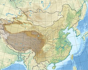
The Dongting Lake ( Chinese 洞庭湖 , Pinyin Dòngtíng Hú , W.-G. Tung-t'ing Hu ) in the north of the Hunan Province is the second largest inland lake in the People's Republic of China . It is fed by several rivers and drains into the Yangtze River north of the lake . The provinces of Hunan ("south of the lake") and Hubei ("north of the lake") have been named after their location in relation to the lake.
The normal area of the lake is 2,820 km²; in summer (July to September), when the floods of the Yangtze River in particular flow into the lake, the area can expand up to 20,000 km². The Dongting Lake thus represents an important natural retention basin for regulating the flow of water in the Yangtze. However, the lake is less and less able to perform this function, as the annual floods exceed the critical levels at ever shorter intervals. In 1998 more than 4,000 people lost their lives, in 2002 it was fewer because the dams held. The floods are less natural and more man-made. The deforestation of protective forests , the draining of wetlands and the creation of residential and industrial areas in areas previously used as floodplain for the lake have resulted in these being irretrievably lost.
The sediment load carried along by the Yangtze and deposited in the Dongting Plain led to the creation of very fertile marshland so that the plain around the lake became one of the most important rice-growing areas in China. As a result, extensive floodplains were also lost.
While the shallow Dongting Lake was the largest inland lake in China at the time of the Han Dynasty , its area has since become smaller due to the reclamation of new land, so that it now ranks second after Lake Poyang .
The rivers flowing into Dongting Lake, including Xiang (2288 m³ / s), Zi (795 m³ / s), Yuan (2158 m³ / s), Li (551 m³ / s) and Miluo , lead the lake on average over 6000 m³ / s of water, making the lake outflow by far the most water-rich tributary of the Yangtze. In addition, three southern tributaries of the Yangtze River reach the lake with a combined mean flow volume of over 3500 m³ / s. They exceed the volume of the Xiang Jiang, making Dongting Lake part of the Yangtze River. Especially from this influx, large amounts of suspended matter settle in the lake basin.
The main cities on the lake are Yueyang and Yuanjiang . Changsha , the capital of Hunan, is located about 60 km southeast of Dongting Lake and can be reached by seagoing vessels via the Yangtze River, Dongting Lake and the Xiang Jiang.
Individual evidence
- ↑ a b Estimated from OpenStreetMap
- ↑ Mean outflows (MQ) of the 4 rivers from: T. Ding, D. Wan, C. Wang, F. Zhang: Silicon isotope compositions of dissolved silicon and suspended matter in the Yangtze River, China ( Memento of the original from March 5 2014 in the Internet Archive ) Info: The archive link was automatically inserted and not yet checked. Please check the original and archive link according to the instructions and then remove this notice. . Geochimica et Cosmochimica Acta, vol. 68, no. 2, pp. 205-216, 2004
- Jump up ↑ a b Wang Xu, Yan Denghua, Xiao Weihua, Zhu Weiyao, Yuan Yong: Evolution of the Hydrological and Hydrodynamic Characteristics in the Outlet Reach of Xiangjiang River . Journal of Environment and Ecology, Vol. 3, No. 1, 2012 ISSN 2157-6092
Web links
- Report on floods at Dongting Lake ( Memento from September 11, 2004 in the Internet Archive )
- The Dongting Lake in central China
