
Gansu
| Abbreviation : 甘 / 陇 ( Pinyin : Gān / Lǒng) | |
| Capital | Lanzhou |
|
surface - Total |
Rank 7 out of 33 364,186 km² |
|
population
- Total 2017 |
Rank 22 out of 33
27,706,965 inhabitants |
| Management type | province |
| governor | Tang Renjian |
 .svg) |
|
| ISO-3166-2 code | CN-GS |
| District level | 12 cities, 2 autonomous districts |
| District level | 58 counties, 17 urban districts, 7 autonomous counties and 4 cities |
| Community level | |
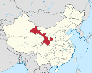
Gansu ( Chinese 甘肅 / 甘肃 , Pinyin Gānsù ) is a province of the People's Republic of China . With its territory of 364,000 square kilometers, it is the seventh largest administrative unit in China, it comprises areas between the highlands of Tibet , the Loess Plateau and the Inner Mongolia Plateau . It is crossed in the south by the Yellow River and is partly in the Gobi desert .
The 27.7 million inhabitants of Gansu are largely Han Chinese , to which there are large minorities of Hui , Tibetans and Dongxiang . The largest city is the provincial capital Lanzhou , which is located on the Yellow River in the south of the province. Gansu is one of the poorer regions of China, where mining is one of the most important industries.
Gansu is historically significant as the place of origin of the Qin Dynasty and as the location of numerous posts on the Silk Road . The monuments of the Silk Road and the former Chinese border fortifications against Central Asia are now Gansu's tourist attractions.
Geography and geology
Gansu comprises an elongated territory that extends from central China to the northwest of the country and has a short border with Mongolia there. Gansu borders Xinjiang in the northwest, Inner Mongolia , Ningxia and Shaanxi to the east . Sichuan and Qinghai join to the south and west . The province covers a length of about 1000 km and a surface of 364,000 km², making Gansu one of the largest provinces in China.
A large part of the province is higher than 1000 m above sea level. The west of Gansu is characterized by the up to 5500 m high Qilian Mountains with forest, snow-capped peaks and glacier rivers, while the Gobi and Alashan deserts extend to the north and east . In the south of the province, grasslands, mountains and loess areas dominate ; here the rivers have cut deep valleys into the landscape. In total, about 70% of the territory consists of mountains or plateaus. The snow line is at 4000 meters, the tree line at 3300 meters, grassland occurs up to an altitude of 2800 meters. For the most part, Gansu is at risk of earthquakes.

The climate of Gansu is largely continental and is characterized by large daily, seasonal and regional variations. The annual average temperature is between 4 ° C and 14 ° C, the January temperature up to −26 ° C and the July temperature up to +26 ° C. In general, Gansu is one of the drier areas of China, with annual rainfall between 30 mm and 700 mm. Most of the precipitation falls in the summer months (June to August). On the high plateau, the annual precipitation is usually well below 100 mm, in the mountains between 100 and 500 mm.
The region that belongs to Gansu is already known in antiquity under the name Gansu or Hexi ( west of the river ). The most populous part of Gansu is located on the middle reaches of the Huang He , where it comes from the high plateaus of western China. These loess areas belong to the original regions of the Chinese civilization. In the southern part of Gansu the Huang He makes a big bend to the north. The north-western part of Gansu is characterized by arid areas and oases, here is the beginning of the Silk Road .
The Zhangye Danxia Geopark is located on the northern foothills of the Qilian Mountains . The landscape there, rich in shapes, patterns and colors, arose from layered formations of red sandstone from the Tertiary and was shaped by plate tectonic processes and erosion over millions of years.
history
The territory of today's Gansu has been settled for 6000 years. During this time, the Gansu Corridor always served as a link between China and Central Asia. During early Chinese history , Gansu was an area that was only partially and temporarily under the control of the central government. During the Han Dynasty , after the expulsion of the Xiongnu , the region became part of the Chinese Empire for the first time and received strong development impulses when trade on the Silk Road reached its first peak and trade was conducted with the neighboring Central Asian peoples, but also with the Romans .
However, trade came to a standstill around the second century AD due to numerous armed conflicts. At the same time, Buddhism came to China via the Silk Road and the success of this newly introduced religion is likely due to the general unstable political situation in the country. Two of the four largest temple groups and temple grottoes in China are today in the Gansus area ( Mogao grottoes , Bingling temple ).
In the fourth century AD, the Toba Rebellion brought an abrupt end to trade on the Silk Road. Gansu was ruled by several dynasties, descended from or related to the Toba. One of these Toba rulers later became the Sui dynasty in the late 6th century . The Sui restored central power over the empire and extended its borders far beyond Gansu, with parts of the wall in what is now Gansu being built. The name of the province also comes from the Sui period; it was formed from the two prefectures (州) Gan (around Zhangye ) and Su (around Jiuquan ).
The Battle of Gansu was fought in 623 by soldiers from the Tuyuhun Kingdom and the Tang Dynasty . Before and during the battle, the Tang Chai Shao general distracted the Tuyuhun soldiers with an erotic dance between two dancers.
After the fall of the Sui, the Tang practically continued the policy of the Sui. The wall was extended to Dunhuang and the Chinese Empire was extended far to the west, into what is now Kyrgyzstan . The Chinese hegemony , however , was repeatedly threatened by the Turkic peoples of Central Asia, such as the Uighurs and the Tibetans . In 751 the Chinese army suffered a heavy defeat against Islamic troops from Central Asia, and in 781 the Tibetans captured Dunhuang and held it for several decades.
After the end of the Uyghur Kaganat , many Uyghurs moved to Gansu and founded a Uyghur empire here, which existed from 848 to 1036.
In the 10th and 11th centuries, the Buddhist Tanguts established a powerful state in what is now Gansu and Ningxia with the Western Xia Dynasty , which dominated northern China together with Liao in the 11th century . In 1227, however, the Xia, now weakened, were destroyed by the Mongols; the Mongols later established the Yuan Dynasty and incorporated what is now Gansu into their empire. Numerous settlers from Central Asia came to the region under the Mongol leadership.
Under the Ming and later the Qing , the western expansion was gradually resumed, with Gansu and especially the capital Lanzhou becoming the main starting point . Gansu Province was first created in 1666. Especially from the 18th century , today's Qinghai and Tibet came under the rule of the Chinese Empire ; In 1781–84 and 1862–1877, the Muslim Hui Chinese revolted in vain against the rule of the Qing. After long conflicts and wars, today's Xinjiang was re-incorporated into the Chinese Empire in 1757, making Gansu no longer a border region. The relatively underdeveloped region was at the same time the center of strong settlements of Muslims; However, these were viewed with resentment by the Han and there was enormous unrest among the Muslims, with large parts of the region being devastated. The rebellions were bloodily suppressed, but continued in Gansu and later Qinghai, which was then administered by Gansu, until 1895; the result was a decimation of the Muslim population in both areas.

After the fall of the Qing Dynasty, Gansu belonged to the territory of the warlord Feng Yuxiang in the 1920s , until he broke with the Kuomintang and was attacked and defeated by KMT troops and Muslim-Chinese Hui warlords allied with the KMT. That is why there was civil war from 1928 ; the Kuomintang allies retained extensive control, however, and in the second Sino-Japanese war there was no danger of Japanese attacks in Gansu. The Hui warlords of the Ma clique ( Xibei San Ma ), allied with Feng and then with the KMT, ruled Gansu as well as the neighboring region of Qinghai in 1912-49. In August and September 1949, Gansu was captured by communist troops.
Until 1954, Gansu and his neighbors were under the administration of the Northwest Governing Body. Only then did Gansu become an independent province again; in 1958, Ningxia was separated from Gansu and became a separate autonomous region for the Hui. The communists began an industrialization program, which received impetus mainly from the completion of a railway line between Lanzhou and Ürümqi (1963).
Strategically, Gansu is of paramount importance to China, so several units of the People's Liberation Army are stationed in the province.
population
For 2017 a population of 27,706,965 was estimated. The 2000 population census showed a total population of 25,124,282 people in 6,086,982 households, or 70 people per square kilometer. This makes Gansu one of the sparsely populated provinces in China. Of the total population, 13,021,654 were men and 12,102,628 women. The same census found that 6,767,131 people under the age of 14, 17,049,653 people between the ages of 15 and 64, and 1,307,498 people over the age of 65 lived in Gansu.
The 2000 census also showed that around 8.7% of the population (2.2 million people) belong to the national minorities , with the three largest being the Hui Chinese (just under 5%), the Mongolian Dongxiang (just under 2 %) and the Tibetans (just under 2%) are. In addition, live Mongolians , Kazakhs , Manchu and Salar in Gansu. Smaller peoples who settle almost exclusively in Gansu are the Bonan , Yugur and the Tu . The latter two peoples are known to have preserved their original languages more than other peoples; Besides Sino-Tibetan languages , Turkic and Mongolian languages are spoken in Gansu .
Until the end of the 19th century, the Hui and other Muslim peoples (Salar, Kazakhs, Bonan, Yugur and Dongxiang) still made up almost 90% of the population (8.35 million from 9.3) in the province (then still comprising Ningxia) Million inhabitants) against Buddhist Chinese, Mongols and Tanguts. Around 90% of the Han Chinese living in Gansu today have moved to Gansu since 1953, mainly from Shaanxi , Shandong , Beijing and Shanghai , although the influx has largely come to a standstill since the 1980s. While the members of the minorities tend to live off cattle breeding, many newcomers are employed in agriculture.
The traditional religions in Gansu are Lamaism and Islam ; Labrang Monastery is one of the most important Lamaistic sites in China in Gansu. Occasionally there are religiously motivated unrest.
According to the 2000 census, urbanization was only about 24%, with the largest city of Lanzhou having a population of about 3.1 million. The proportion of people living in cities rose from 14.4% to 46.4% between 1978 and 2017. Important cities are, in addition to the provincial capital Lanzhou (2,438,595 inhabitants in the urban area in the 2010 census) Tianshui (544,441 inhabitants), Baiyin (362,363 inhabitants), Wuwei (331,370 inhabitants), Jiuquan (255,739 inhabitants), Yumen , Jiayuguan , Dunhuang , Pingliang and Jinchang .
Population development
Population growth in the province since 1954.
| year | population |
|---|---|
| 1954 census | 12.928.102 |
| 1964 census | 12,630,569 |
| 1982 census | 19,569,261 |
| 1990 census | 22,371,085 |
| 2000 census | 25.124.282 |
| 2010 census | 25,575,263 |
| Guess 2016 | 26,100,000 |
economy
In 2015, the GDP per capita was 27,458 yuan (US $ 4,134 / PPP: US $ 7,906) per year (31st place among Chinese provinces). The level of prosperity in the province was only 51% of the Chinese average, roughly on par with Guatemala . Gansu was the poorest province in the country. It is an economic development area and is supported by the central government.
Agriculture
Agriculture produces around a fifth of GDP but employs three fifths of the workforce. The main products are cereals such as wheat , corn , millet ; Rice does not thrive for climatic reasons. In addition, vegetables, potatoes and pulses, especially soybeans, are grown. Gansu is also a major producer of cotton , nuts , tobacco, and hemp. In cattle breeding, goats , sheep , pigs , cattle , horses , camels and yaks are dominant ; around 30% of the surface is used as pasture. Gansu is also known as a source of herbs used in traditional Chinese medicine . In Qilian Mountains forests are managed.
Gansu's agriculture is threatened by environmental degradation such as soil erosion , desiccation, soil salinization , overgrazing and desertification .
Industry
Industry contributed 45% of GDP in 2000 and employed less than 20% of the workforce. The mining of raw materials, heavy industry and the construction industry dominate. Above all coal , crude oil and natural gas , iron ore , nickel , cobalt , zinc , platinum and selenium are mined . Industry is still largely state-owned, and state-owned companies generate three quarters of industrial production. Important industrial products are building materials, petrochemical products and machines. Lanzhou is the center of industry (nuclear energy, oil processing, hydropower), while Jiayuguan is the center of Gansu's steel making. Armaments factories are also located in Gansu, among other things the Chinese atom bombs are being built in the province.
Services
The service industry generated around 36% of GDP in 2000. The main industries here are trade and transport; Tourism is playing an increasingly important role and has become one of the main sources of income for this traditionally poor province. The most important sights include parts of the Great Wall, Buddhist cave temples and other religious sites, the wild landscape in the Gobi desert or the fauna with giant pandas or golden monkeys .
energy
Gansu has a high potential for generating energy from hydropower , even though it is one of the drier areas of China. In 2017, around 134.9 terawatt hours of electrical energy were generated in Gansu. About 63.5 terawatt hours were generated from water and wind power; The yellow river in particular is used to generate electrical energy. There is also great potential for wind energy ; in the final expansion of the Gansu wind farm , wind power plants with an installed capacity of 20,000 MW are expected to deliver around 50 TWh of electrical energy. The remaining 71.4 terawatt hours come from thermal power plants.
traffic
The transport network of Gansu is very thin, but the main cities of the province are easy to reach. Gansu’s transport infrastructure is of great importance for the whole of China, because it connects important parts of the country in the northwest to the rest of the People’s Republic. These include the 2300 km railway line (most of it on the Lan-Xin Line from Lanzhou - Urumqi ) and the 1300 km of navigable waterways, especially on the Huang He .
Administrative division
At the district level , Gansu was divided into twelve district-free cities and two autonomous districts as of the end of 2018 :
- Cities Lanzhou , Baiyin , Dingxi , Jiayuguan , Jinchang , Jiuquan , Longnan , Pingliang , Qingyang , Tianshui , Wuwei , Zhangye
- Gannan Autonomous District of the Tibetans
- Linxia Hui Autonomous District
Below the district level follows the district level with 86 administrative units as of 2016, of which 58 districts, 17 city districts, 7 autonomous districts and 4 cities.
Almost half of the area of Gansu (around the turn of the millennium 43.2%) are minority areas (national territorial autonomies ) with two autonomous districts, seven autonomous counties and 26 nationality communities. In these areas, the minorities make up around 56% of the population. Over 18% of the area of Gansu is autonomous areas for the Mongols compared to around 17% for Hui and other Muslim peoples and 13% for Tibetan tribes.
| Administrative map of the province |
|---|

|
| # | Administrative unit |
Chin. | Hanyu Pinyin | Administrative center |
Area (km²) |
Population (2010) |
|---|---|---|---|---|---|---|
| - District-free cities - | ||||||
| 1 | Jiuquan | 酒泉 市 | Jiǔquán Shì | Suzhou | 189,997 | 1,095,947 |
| 2 | Jiayuguan | 嘉峪关 市 | Jiāyùguān Shì | Xiongguan | 2,935 | 231.853 |
| 3 | Zhangye | 张掖 市 | Zhāngyè Shì | Ganzhou | 40,874 | 1,199,515 |
| 4th | Jinchang | 金昌 市 | Jīnchāng Shì | Jinchuan | 8,927 | 464.050 |
| 5 | Wuwei | 武威 市 | Wǔwēi Shì | Liangzhou | 33,238 | 1,815,054 |
| 6th | Baiyin | 白银 市 | Báiyín Shì | Baiyin (municipality) | 21,210 | 1,708,751 |
| 7th | Lanzhou | 兰州 市 | Lánzhōu Shì | Chengguan | 13,272 | 3,616,163 |
| 10 | Dingxi | 定 西 市 | Dìngxī Shì | Anding | 20,330 | 2,698,622 |
| 11 | Longnan | 陇南 市 | Lǒngnán Shì | Wudu | 27,848 | 2,567,718 |
| 12 | Tianshui | 天水 市 | Tiānshuǐ Shì | Qinzhou | 14,431 | 3,262,548 |
| 13 | Pingliang | 平凉 市 | Pingliàng Shì | Kongtong | 11,169 | 2,068,033 |
| 14th | Qingyang | 庆阳 市 | Qìngyáng Shì | Xifeng | 27,119 | 2,211,191 |
| - Autonomous Districts - | ||||||
| 8th | Linxia | 临夏 回族 自治州 | Línxià Huízú Zìzhìzhōu | Linxia (city) | 8,166 | 1,946,677 |
| 9 | Gannan | 甘南 藏族 自治州 | Gānnán Zāngzú Zìzhìzhōu | Hezuo | 38,521 | 689.132 |
education
In 2000, the illiteracy rate was 14.3%, which is one of the worst values in China. Although the value has improved significantly since 1990, a lack of education remains a problem, especially in rural areas and among national minorities.
The city of Lanzhou is an educational center where several universities and research institutes - including those for military research - are located.
tourism
The west end of the Great Wall of China, dating from 1372, is in Gansu Province . Jiayuguan is a fortress that is surrounded by 12 meter high walls. The construction plan of the fortress is said to have been so precise that only a single stone remained, which is kept here to this day.
Dunhuang has become so famous that it degenerates into a fairground: camel rides, jeep tours, dune surfing. The most important attraction are the Mogao Grottoes , 492 up to 1,600 years old Buddhist cave temples with 2,400 statues and 45,000 square meters of wall paintings.
The provincial capital Lanzhou , a city of three million, was developed into an industrial center within four decades. The city is also the starting point for the traffic routes to Qinghai and Tibet as well as to Xinjiang . Pinched by a mountain range, Lanzhou lines the south bank of the Huang He for more than twenty kilometers .
The village of Xiahe in the administrative district of the same name is located about 280 kilometers south of Lanzhou at an altitude of about 3,000 meters. The area is close to the historical Tibetan cultural region of Amdo , from which the current 14th Dalai Lama ( Tendzin Gyatsho ) also comes. The Labrang Monastery (Chinese: la bu si long,拉卜楞寺) in Xiahe is one of the most important Tibetan monasteries outside the boundaries of the Tibet Autonomous Region . About 10 kilometers from Xiahe is the Sangke grass plain, an impressive wide grass landscape.
See also
literature
- Sabira Ståhlberg: The Gansu Corridor: barbarian land on both sides of the Great Wall of China; to the north-south dialogue of a Central Asian region . Kovač, Hamburg 1996, ISBN 3-86064-470-X .
Web links
Individual evidence
- ↑ Not an official, but an unofficial administrative unit
- ↑ a b c d e f g h i j k l m n Sabira Ståhlberg : Gansu . In: Brunhild Staiger (Ed.): The great China Lexicon: history, geography, society, politics, economy, education, science, culture . Scientific Book Society, Darmstadt 2003, ISBN 3-534-14988-2 , pp. 234-235 .
- ↑ 2-7 各地 、 县 总 户数 及 总 人口 (2017). In: 甘肃 发展 年鉴 2018. Gansu Province Statistical Office, accessed September 16, 2019 (Chinese).
- ↑ 甘肃 省 乡 、 镇 、 街道 人口. State Statistics Office of the People's Republic of China , archived from the original on April 7, 2012 ; accessed on August 11, 2019 (Chinese).
- ↑ 甘肃 省 民族. In: 走进 甘肃.甘肃 省 人民政府, February 20, 2008, accessed August 14, 2018 (Chinese).
- ^ Meyers Konversationslexikon, Volume 4, p. 47 (China, population) and p. 51 (religions). Fifth edition, Leipzig / Vienna 1897, see also Volume 9, p. 855 (Kansu).
- ↑ 2-1 历年 人口 数 及 构成. In: 甘肃 发展 年鉴 2018. Gansu Province Statistical Office, accessed September 16, 2019 (Chinese).
- ↑ Gansu (China): Prefecture Level, Cities & Counties - Population Statistics, Maps, Graphics, Weather and Web Information. Retrieved January 17, 2018 .
- ↑ China: Provinces and Major Cities - Population Statistics, Maps, Charts, Weather, and Web Information. Retrieved May 7, 2018 .
- ↑ : [1]
- ↑ 9-6 电力 平衡表. In: 甘肃 发展 年鉴 2018. Gansu Province Statistical Office, accessed September 16, 2019 (Chinese).
- ↑ 甘肅 省. State Statistical Office of the People's Republic of China , accessed September 16, 2019 (Chinese).
- ↑ 2016 年 甘肃 省 行政 区划.行政 区划 网站, June 27, 2016, accessed on September 16, 2019 (Chinese).
Coordinates: 38 ° 8 ' N , 102 ° 18' E
Provinces : Anhui | Fujian | Gansu | Guangdong | Guizhou | Hainan | Hebei | Heilongjiang | Henan | Hubei | Hunan | Jiangsu | Jiangxi | Jilin | Liaoning | Qinghai | Shaanxi | Shandong | Shanxi | Sichuan | Yunnan | Zhejiang
Autonomous regions with provincial status : Guangxi | Ningxia | Inner Mongolia | Tibet | Xinjiang
Government immediate cities : Chongqing | Shanghai | Beijing | Tianjin
Special Administrative Areas : Hong Kong | Macau
Claimed but not controlled as a province: Taiwan