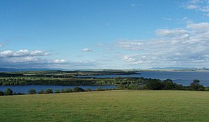
Reservoir Nechranice
| Reservoir Nechranice | |||||||
|---|---|---|---|---|---|---|---|
| Reservoir Nechranice | |||||||
|
|||||||
|
|
|||||||
| Coordinates | 50 ° 22 '14 " N , 13 ° 25' 9" E | ||||||
| Data on the structure | |||||||
| Construction time: | 1961-1968 | ||||||
| Height of the barrier structure : | 47.5 m | ||||||
| Crown length: | 3 280 m | ||||||
| Power plant output: | 10 MW | ||||||
| Data on the reservoir | |||||||
| Altitude (at congestion destination ) | 273 m nm | ||||||
| Water surface | 13.38 km² | ||||||
| Storage space | 287 600 000 m³ | ||||||
The reservoir Nechranice (also reservoir Negranitz ; Czech Nechranická přehrada ) is a process water reservoir in the Czech Republic .
geography
The reservoir is located 8 km east of Kadaň in 273 m nm in the area of the municipalities of Březno and Chbany . It has a water surface of 1338 hectares and holds 287.6 million m³ of water.
To the northeast are the Tušimice I and II power plants, and the Hradec substation to the west . Surrounding places are Březno in the north, Kopeček, Střezov and Holetice in the north-east, Vičice, Stranná, Nechranice, Soběsuky and Roztyly in the east, Chbany and Přeskaky in the south-east, Vikletice, Vadkovice, Malé Krhovice and Poláky in the south, Hoesten and Nováky in the south u Rokle in the west.
history
The reservoir was constructed between 1961 and 1968 along a ridge on a large meander of the Eger. The villages Čachovice ( Tschachwitz ), Čermníky ( Tschermich ), Drahonice ( Drohnitz ), Lomazice ( Lametitz ), Chotenice ( Kudenitz ), Běšice ( Weschitz ) and Dolany ( Dehlau ) were cleared and flooded. The Schaboglück – Priesen (Žabokliky – Březno) railway ran in the area of the dam between 1873 and 1879 . Remnants of this first railway line, which was closed in Bohemia, are still visible near the dam.
The reservoir is used today to balance water on the Eger and is a process water reservoir. The northern bank area is characterized by the power plants and post-mining landscapes. In the southeast near Vikletice several campsites and a marina have been built.
Investments
The 47.5 m high dam of the reservoir leads over the sheath between the Komotau and the five-dog part of the North Bohemian lignite basin. The local road from Kopeček to Vikletice leads over the 3.28 km long and 9 m wide dam crest.
In the reservoir there is a small power plant with two KT 6-K-50 Kaplan turbines, each with an output of 5 MW.
Individual evidence
- ↑ Negranitz dam (Nechranická přehrada) - excursion destinations in the Ore Mountains - Bohemian Ore Mountains

