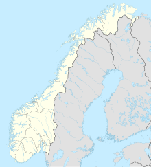
Storrsheia
Coordinates: 58 ° 38 '58.7 " N , 6 ° 2' 51.4" E
The valley of Storrsheia is 200–225 m high, in the hills of Vikeså ( Vigeså ), municipality ( municipality ) Bjerkreim in Rogaland , in southwestern Norway . On both sides of the road from Kristiansand to Stavanger , is located 51 km before Stavanger one explored by Jan Petersen in the years 1929 and 1930 deserted . The eleven hectare area consists of the remains of six houses, a wall encompassing the complex, cattle paths and more than one hundred artificial mounds or some removed cairns . All six courtyards and three of the mounds have been excavated.
Uadal farm
Uadal farm , across the Storrsheivatnet (lake), is the best preserved in southwestern Norway. The Metal Age settlement of the Storrsheia valley begins in the 4th century. On the basis of the artefacts found, mostly ceramic shards, the excavator determined at least two phases of settlement. Initially four farms were inhabited, each with its own cattle path leading to the surrounding wall. A fifth house should have been used as a forge because of the crucibles found in the ruins. The courtyards consist of longhouses common in southwest Norway. The house type is typical even before the Migration Period and was found at Forsand around the turn of the century.
The houses
House 1 (306 m²) is the longest at 39.5 meters and 7.75 meters wide. The other houses in the complex are 320, 220 and 150 m² in size. A woman's funeral could be dated to the Viking Age based on the grave goods (including bronze clasp and spindle whorl ) . In addition to House 2, evidence of Late Iron Age or Viking Age use was found in other houses. However, because these consist almost entirely of pottery, it is uncertain whether the settlement was continuously inhabited. However, the excavation report and the drawing make it more likely that this house also had a forerunner during the Migration Period.
Storrsheia is a model case for the emergence of complex settlements in Norway in the pre-Viking Age. It is a new form of settlement with several courtyards that are located within an enclosure that separates the built-up from the undeveloped land. It can be assumed that there was some form of cooperation between the farms. While Storrsheia is the largest explored desert, there are much larger complexes in nearby Jæren . Obrestad in Jæren appears to have comprised around 25 hectares and four farms. Other complexes consisted of five courtyards.
In the burial mound on the eastern wall of the building, 600 pieces of broken glass at various levels of the hill and corpse burns were found.
literature
- Bjørn Myhre: Gårdsanlegget på Ullandhaug. 1: Gårdshus i jernalder og tidlig middelalder i Sørvest-Norge = The Iron Age settlement on Ullandhaug. 1: The houses of the Iron Age and Early Medieval courts in south-west Norway. Stavanger 1980.
- Ottar Rønneseth: "Gard" and enclosure. Development phases of the agricultural landscape of Jæren . Stockholm 1974.
Web links
Two short reports with site plans, an overview map and other illustrations of the settlement's environment:
