Formosa Street
| Formosa Street | ||
|---|---|---|
| Formosa Street | ||
| Connects waters | East China Sea | |
| with water | South China Sea | |
| Separates land mass | Taiwan | |
| of land mass | mainland china | |
| Data | ||
| Geographical location | 24 ° 48 ' N , 119 ° 54' E | |
|
|
||
| Smallest width | 180 km | |
| Islands | Pescadors , Matsu Islands , Kinmen | |
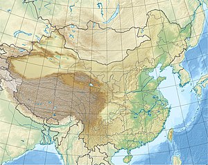
The Formosa Strait ( Chinese 福爾摩沙 海峽 / 福尔摩沙 海峡 , Pinyin Fú'ěrmóshā Hǎixiá ), also known as the Taiwan Strait ( 臺灣 海峽 / 台湾 海峡 , Táiwān Hǎixiá ), is the 180 km wide strait between the Chinese province of Fujian in the west and the island of Taiwan (formerly Formosa ) in the east, which connects the East China Sea in the north and the South China Sea in the south. It is one of the busiest waterways (container traffic along the Chinese coast), on which there are also many fishing boats.
The Formosa Strait is of geostrategic importance because it separates the Republic of China on Taiwan from the People's Republic of China on the mainland. In the 1950s there was a risk of a military conflict between the People's Republic of China on the one hand and the Republic of China in alliance with the United States on the other. Mao Zedong had Quemoy Island , which is in sight off the coast of Fujian but administered from Taiwan, bombed.
As part of Deng Xiaoping's policy of opening up, fishermen on both sides started smuggling. Since the late 20th century, hundreds of thousands of Taiwanese have come to Fujian as tourists, family visits, and investors .
On Formosa Street there are some operating or under construction offshore wind farms such as Longyuan Putian Nanri Island , Putian Pinghai Bay or Formosa .

