Sulmsee
| Sulmsee | ||
|---|---|---|

|
||
| Geographical location | Leibnitz , Leibnitz District , Styria , Austria | |
| Tributaries | Kogelgrabenbach | |
| Drain | Kogelgrabenbach to Sulm | |
| Location close to the shore | Leibnitz | |
| Data | ||
| Coordinates | 46 ° 46 '34 " N , 15 ° 30' 49" E | |
|
|
||
| Altitude above sea level | 275 m above sea level A. | |
| surface | 0.19 km² | |
| length | 890 m | |
| width | 330 m | |
| Maximum depth | 3 m | |
The Sulmsee is an artificially enlarged fish and bathing pond west of Leibnitz , Styria .
The Sulmsee is fed by the Sulm , by the Kogelgrabenbach flowing to the north and by a well system, which can also be used to regulate the water level. It is divided into two basins by a dam.
Originally the Sulmsee was a much smaller lake or a swamp area at the confluence of the Sulm and Kogelgrabenbach.
Individual evidence
- ↑ a b c Sulmsee on bergfex.at
- ↑ a b Geodatenviewer Geoland.at of the geodata portal of the Austrian federal states ( information )
Web links

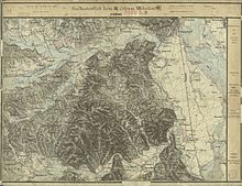
Leibnitz and the lower course of the Sulm, 1879, 3rd land survey
