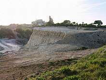
Sutrum-Harum
Sutrum-Harum is a farming community in the Neuenkirchen community in northern Münsterland . The peasantry originally consisted of the Harhem and Suthem peasants.
location
Sutrum-Harum is located east of the center of Neuenkirchen. In the north of Sutrum-Harum is the Thieberg , where the peasantry borders on Landersum and the Rhine district of Wadelheim . In the east to the Rhine districts of Dutum and Catenhorn . St. Arnold is in the south of Sutrum-Harum . The Wambach flows through the peasantry from west to east.
history
In the founding deed of the community of Neuenkirchen of January 7, 1247, the farmers Harhem (Harum) and Suthem (Sutrum) are still listed individually. The settlement of the peasantry took place possibly in the 9th century during the time of Charlemagne . According to some researchers, the endings “hem” = “um” = “home” could indicate this. In Sutrum there was also a Schultenhof , Schulte-Sutrum (today Tönnern).
swell
- “Along the village”; Karl Evers, July 29, 1947
- Neuenkirchen 750 years (August 1997)
- Cycling guide Neuenkirchen; “Experiencing Stories”, May 2005
Coordinates: 52 ° 15 ' N , 7 ° 23' E

