Tīrī Rūd
| Tīrī Rūd | ||
|
The Tīrī Rūd is the left tributary of the Hilmend north of the Arghandāb |
||
| Data | ||
| location | Ghazni , Urusgan ( Afghanistan ) | |
| River system | Helpful | |
| Headwaters | in the southwest of the province of Ghazni 33 ° 19 ′ 18 ″ N , 67 ° 4 ′ 38 ″ E |
|
| Source height | approx. 3900 m | |
| muzzle | at Dehrawud in the Hilmend coordinates: 32 ° 38 '42 " N , 65 ° 26' 45" E 32 ° 38 '42 " N , 65 ° 26' 45" E |
|
| Mouth height | approx. 1110 m | |
| Height difference | approx. 2790 m | |
| Bottom slope | approx. 14 ‰ | |
| length | approx. 200 km | |
| Catchment area | 8055 km² | |
| Discharge at the Urusgan A Eo gauge : 1060 km²
|
MQ 1970/1980 Mq 1970/1980 |
7.33 m³ / s 6.9 l / (s km²) |
| Discharge at the Tarin Kut A Eo gauge : 3680 km² |
MQ 1969/1980 Mq 1969/1980 |
12.8 m³ / s 3.5 l / (s km²) |
| Discharge at the Anarjuy Dehrawud A Eo gauge : 8055 km² |
MQ 1951/1979 Mq 1951/1979 |
16 m³ / s 2 l / (s km²) |
| Right tributaries | Choir | |
| Small towns | Tarin Kut | |
| Communities | Dehrawud | |
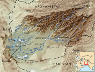
The Tīrī Rūd ( English Tirin River ) is an approx. 200 km long left tributary of the Hilmend in southern Afghanistan .
It rises in the southwest of the Ghazni province . From there it flows in a westerly direction through the province of Urusgan . At the provincial capital Tarin Kut the choir coming from the north on the Tīrī Rūd. The river flows another 50 km in a westerly direction before it flows into the Hilmend at Dehrawud . The Tīrī Rūd drains an area of 8055 km². The mean discharge at the mouth is 16 m³ / s.
Hydrometry
Average monthly discharge of the Tīrī Rūd (in m³ / s) at the Anarjuy / Dehrawud gauge (6 km above the confluence with the Hilmend)
measured from 1951 to 1979

Web links
Individual evidence
- ↑ a b c d Tara Williams-Sether: Streamflow Characteristics of Streams in the Helmand Basin, Afghanistan (PDF; 5.31 MB) USGS.
