Tabankort
| Tabankort | ||
|---|---|---|
|
|
||
| Coordinates | 17 ° 51 ′ N , 0 ° 19 ′ E | |
| Basic data | ||
| Country | Mali | |
| Gao | ||
| circle | Gao | |
| ISO 3166-2 | ML-7 | |
|
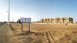
Tin Fouyé Tabankort (2016)
|
||
Tabankort is a place in the northeast of Mali . Tabankort is located on the southern edge of the Adrar n Ifoghas mountain range on the Tanezrouft slope .
population
The population consists mainly of semi-settled Tuareg ; who mainly belong to the clans of the Ifoghas and the Idnan.
climate
The lowest average temperature is 21 ° C in January, the highest in June 35 ° C. The rainy season lasts from July to September in good years. In bad years there is no precipitation at all.

