Taftan (volcano)
| Taftan | ||
|---|---|---|
|
NASA satellite image |
||
| height | 3940 m | |
| location | Sistan and Balochistan , Iran | |
| Coordinates | 28 ° 36 ′ 0 ″ N , 61 ° 8 ′ 0 ″ E | |
|
|
||
| Type | Stratovolcano | |
| Last eruption | April 25, 1993 | |
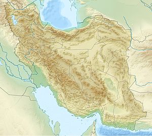
Taftan ( Persian تفتان Taftân , 'The Place of Heat') is an active stratovolcano in southeastern Iran in the province of Sistan and Balochistan . At almost 4000 m above sea level, it is one of the highest mountains in southeast Iran. The closest city is Khash . The highest peak is named Cheheltan. Various gases are emitted, including water vapor, sulfuric acid , sulfur dioxide , hydrogen sulfide and carbon dioxide .
According to the Global Volcanism Program , highly active sulfur-covered fumaroles arise on the southeastern summit. In January 1902 it was reported that the volcano was emitting very heavy smoke for several days. In 1993 a lava flow was reported. But it may be molten sulfur that was mistaken for lava.
See also
Web links
- Taftan (volcano) in the Global Volcanism Program of the Smithsonian Institution (English)
Individual evidence
- ↑ The book of Iran: a survey of the geography of Iran - Kiyānoosh Kiyāni Haftlang, Kiyānūsh Kiyānī Haft Lang, Āzitā Rajabi - ISBN 964-94491-3-2

