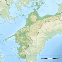
Takanawa Peninsula
| Takanawa Peninsula | ||
| Geographical location | ||
|
|
||
| Coordinates | 33 ° 59 ′ N , 132 ° 55 ′ E | |
| Waters 1 | Seto Inland Sea | |
| length | 35 km | |
| width | 30 km | |
The Takanawa Peninsula ( Japanese 高 縄 半島 , Takanawa-hantō ) is a peninsula in the northwest of the Japanese main island Shikoku . The peninsula is surrounded by the marine region Itsuki-nada in the west and Hiuchi-nada in the east, which belong to the Seto Inland Sea . The Geiyo Islands extend to the north . On the peninsula are the communities belonging to Ehime Prefecture Matsuyama in the west, Imabari in the north and Saijō in the southeast. The highest point is the mountain Higashi-Sampōgamori ( 東三方ヶ森 ; 33 ° 54 ' N , 132 ° 58' O ) m with 1232.8.
