Talang
| Talang | ||
|---|---|---|
|
Gunung Talang behind a tea plantation |
||
| height | 2597 m | |
| location | Sumatra , Indonesia | |
| Coordinates | 0 ° 58 ′ 48 ″ S , 100 ° 40 ′ 48 ″ E | |
|
|
||
| Type | Stratovolcano | |
| Last eruption | 2007 | |
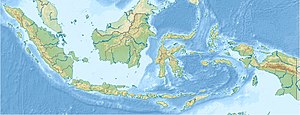
The Talang ( Indonesian Gunung Talang, also Gunung Tallang , Gunung Salasi , Gunung Soelasih ) is a stratovolcano on the Indonesian island of Sumatra . The volcano is located in the province of Western Sumatra about 35 kilometers east of the city of Padang .
From historical times, eruptions of the Talang in the years 1833, 1843, 1845, 1876, 1963, 1967 and 1968 are known. Most of them were small to medium explosive eruptions from smaller craters located in a valley northeast of the summit. The summit with a height of 2597 meters has no crater.
In 1986 a solfatar field on the Talang was enlarged ; in September 2001 there was a phreatic explosion . In April 2005, after ash eruptions , several thousand people were temporarily evacuated from villages within five kilometers of the Talang. There were further ash eruptions in 2006 and 2007. After a tectonic earthquake in western Sumatra in August 2009, numerous earthquakes were registered in the Talang. Another volcanic eruption failed to materialize.
Web links
Talang in the Global Volcanism Program of the Smithsonian Institution (English)
Individual evidence
- ↑ Talang - synonyms & subfeatures in the Global Volcanism Program (accessed February 11, 2013)
- ^ Talang - Monthly Reports in the Global Volcanism Program (accessed February 11, 2013)

