Mountain Dell Dam
| Mountain Dell Dam | |||||||
|---|---|---|---|---|---|---|---|
|
|||||||
|
|
|||||||
| Coordinates | 40 ° 45 '2 " N , 111 ° 43' 19" W | ||||||
| Data on the structure | |||||||
| Construction time: | 1916 to 1917 | ||||||
| Height above foundation level : | 44 m | ||||||
| Crown length: | 172 m | ||||||
| Data on the reservoir | |||||||
| Storage space | 3.7 million m³ | ||||||
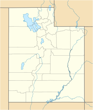
The dam Mountain Dell ( English Mountain Dell Dam ) is a dam in Salt Lake County , State of Utah , USA , which the Parleys Creek dammed. It lies in the Wasatch chain and serves to supply drinking water. The dam is located approximately 9.5 km (6 miles ) east of Salt Lake City . The Interstate 80 leads past the dam. About 2.5 km upstream is the Little Dell Dam .
Barrier structure
The shut-off is a combination of Cob and multiple arch dam of concrete with a height of 44 m (145 ft ) above the foundation bed . The length of the top of the wall is 172 m (565 ft). The barrier structure consists of 16 arches supported by pillars. The thickness of an arch is 1.22 m (4 ft) at the base and 0.38 m (1.25 ft) at the crown. The thickness of one of the buttresses is 2.4 m (8 ft) at the base and 0.61 m (2 ft) at the crown.
The arch dam was built from 1916 to 1917 with an initial height of 32 m (105 ft). The remaining 12 m (40 ft) were added in 1924. In 1938 and 1959, shotcrete was placed on the water side of the dam .
In 1983, melting snow led to a flood that almost flooded the barrier structure. As a result, the Little Dell dam was built upstream and the storage target of Mountain Dell was reduced to 2/3 of the maximum possible storage target. In 1995, a dam survey in the state of Utah was conducted. It found that Mountain Dell's flood relief, 3.65 m (12 ft) wide, is under-sized and does not meet state minimum requirements.
Reservoir
At the maximum storage target , the reservoir holds around 3.7 million m³ (3000 acre-feet ) of water.
See also
Web links
- Mountain Dell Dam, Parley's Canyon, Northwest side of I-80, West of State Route 39, Salt Lake City, Salt Lake County, UT. Library of Congress , accessed January 11, 2019 .
- Mountain Dell Dam - Salt Lake City, Utah (from min 1:02). YouTube , May 14, 2016, accessed January 11, 2019 .
Individual evidence
- ^ A b National Register of Historic Places Inventory Nomination Form Mountain Dell Dam. npgallery.nps.gov, May 20, 1980, pp. 2–3 , accessed on January 11, 2019 .
- ↑ High hazard dams. www.deseretnews.com, March 20, 2005, accessed January 11, 2019 .
- ↑ a b MOUNTAIN DELL, OTHER DAMS NEED WORK. www.deseretnews.com, October 23, 1995, accessed January 11, 2019 .


