Victoria dam
| Victoria dam | ||
|---|---|---|
| location | ||
|
|
||
| Coordinates | 7 ° 14 '30 " N , 80 ° 47' 6" E | |
| country |
|
|
| place | Central Province | |
| Waters | Mahaweli | |
| power plant | ||
| owner | Ceylon Electricity Board (CEB) | |
| operator | CEB | |
| construction time | 1978-1985 | |
| Start of operation | 1985 | |
| technology | ||
| Bottleneck performance | 210 megawatts | |
| Turbines | Francis turbines : 3 × 70 MW | |
| Others | ||
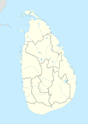
The Victoria Dam ( English Victoria Dam ; Sinhala : වික්ටෝරියා වේල්ල) is located in the center of Sri Lanka in the central province . It dams the Mahaweli , the longest river in Sri Lanka. Upstream and west of the dam is the city of Kandy . Downstream is the Randenigala dam .
The dam is a double-curved concrete arch dam with a height of 122 m. This makes it the highest dam in Sri Lanka. The length of the top of the wall is 520 m and the thickness of the dam is between 6 and 25 m. With the maximum storage target , the reservoir extends over an area of around 23 km² and holds 721 million m³ of water. Construction of the dam began in August 1978 and was completed in April 1985.
power plant
With an installed capacity of 210 MW, the Victoria power plant is the largest hydropower plant in Sri Lanka. When the power plant was commissioned in April 1985, three machines with a maximum output of 70 MW each were installed. A 5.6 km long and 6 m wide tunnel leads from the dam to an engine house in which the Francis turbines are located.
Electricity generation fluctuates: it was 496 million kWh in 2004 and 344 or 351 million kWh in 2004 and 2005.
The power plant is owned by the Ceylon Electricity Board (CEB) and is also operated by CEB.
See also
Web links
- Dams in Sri Lanka (Engl.)
- Data for Victoria (Engl.)

