Temotuloto
| Temotuloto | ||
|---|---|---|
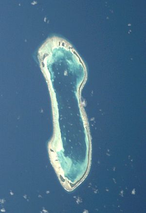
| Satellite image of the Nukulaelae Atoll. | ||
| Waters | Pacific Ocean | |
| Archipelago | Nukulaelae | |
| Geographical location | 9 ° 25 ′ S , 179 ° 51 ′ E | |
|
|
||
Temotuloto is a small reef island in the reef rim of the Nukulaelae Atoll in the island state of Tuvalu .
geography
Temotuloto forms together with Fenulaiago , Aula , Temotutafa , Temotuloto and Teafatule the southern reef edge of the atoll. The island lies on the inner edge of the coral ring. A sandbar extends to the outer side.
Individual evidence
- ↑ Map of Nukulaelae Atoll. Tuvaluislands.com.
- ^ British Admiralty Nautical Chart 766 Ellice Islands. 21 March 1872, United Kingdom Hydrographic Office (UKHO) 1893.
- ↑ geonames.org .

