Tenderingssee
| Tenderingssee | ||
|---|---|---|

|
||
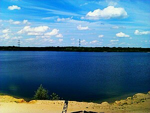
| View of the Tenderingssee | ||
| Geographical location | Wesel district | |
| Data | ||
| Coordinates | 51 ° 35 '52 " N , 6 ° 43' 20" E | |
|
|
||
| surface | 45 ha | |
| scope | 4.255 km | |
| Maximum depth | 15 m | |
| Middle deep | 9 m | |
The Tenderingssee is a by Auskiesung incurred lake in Wesel on the northwestern edge of the Ruhr area . The lake has an area of 45 ha and a maximum depth of 15 m. The lake has been an EC bathing water since 1996.
geography
The Tenderingssee lies between Voerde , the Hünx district of Bruckhausen and Dinslaken on the Lower Rhine .
use
To the west of the lake there is a beach in a bay. In addition to being used as a bathing lake , gravel mining is carried out on the lake.
Surroundings
In the south of the Tenderingssee there are two more lakes, which are still referred to as "dredging holes". They used to be used for bathing. Today they are under nature protection.
Web links
Commons : Tenderingssee - Collection of images, videos and audio files
Individual evidence
- ↑ Bathing water profile according to Art. 6 of the EC Bathing Water Directive 2006/7 / EEC. (PDF; 405 Kb) In: badegewaesser.nrw.de. Ministry for the Environment, Agriculture, Nature and Consumer Protection of the State of North Rhine-Westphalia , 2019, accessed on July 30, 2019 .
- ↑ a b Tenderingssee in Hünxe - ruhr guide
