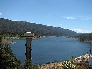
Thomson Dam
| Thomson Dam | |||||||||
|---|---|---|---|---|---|---|---|---|---|
| Thomson Dam | |||||||||
|
|||||||||
|
|
|||||||||
| Coordinates | 37 ° 50 ′ 28 " S , 146 ° 24 ′ 3" E | ||||||||
| Data on the structure | |||||||||
| Construction time: | 1976-1983 | ||||||||
| Height of the barrier structure : | 166 m | ||||||||
| Building volume: | 14.17 million m³ | ||||||||
| Crown length: | 590 m + 580 m secondary embankment | ||||||||
| Power plant output: | 7.5 MW | ||||||||
| Data on the reservoir | |||||||||
| Water surface | 22.3 km² | ||||||||
| Storage space | 1123.09 million m³ | ||||||||
| Catchment area | 487 km² | ||||||||
| Design flood : | 1 040 m³ / s | ||||||||
| Particularities: |
second highest dam in Australia |
||||||||
The Thomson Dam ( Thomson Dam ) is located about 130 km east of Melbourne in Gippsland near the former Beardmore settlement and Baw Baw National Park in Australia . The dam dams the Thomson River to Lake Thomson .
The barrier structure is a 166 meter high earth and stone embankment dam , which was completed in 1983. It is the second tallest dam in Australia after the Dartmouth Dam . Its purpose is to provide drinking water for Melbourne . It is fed through a tunnel branching off at the north end of the reservoir into the Upper Yarra Reservoir and from there into the Silvan Reservoir, from where it is distributed to Melbourne. The facility is operated by Melbourne Water. In recent years there has been a shortage of water, so the basin has not been full since 1996.
In addition to the 590 m long main structure, there is a side dam, which is also 580 meters long. The side dam is included in the specified building volume of 14.17 million cubic meters.
The small connected hydropower plant has an output of 7.5 MW and generates 60 GWh of electricity per year.
See also
- List of the largest dams on earth
- List of the largest reservoirs on earth
- List of the largest hydroelectric plants in the world
- List of dams in the world
Web links
- Thomson Reservoir
- data sheet
- Lowdown on the Thomson Reservoir - The Age, June 5, 2003
- Crunch time today for Thomson Dam - The Age, December 13, 2006
- 'Drought-proof' dam hits record low level
- ANCOLD information

