Tinhosa Grande
| Tinhosa Grande | ||
|---|---|---|
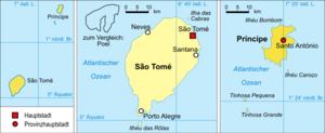
| The third partial map shows the two Tinhosa Islands south of Principé | ||
| Waters | Gulf of Guinea | |
| Archipelago | Pedras Tinhosas | |
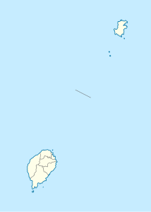
| Geographical location | 1 ° 20 ′ 30 " N , 7 ° 17 ′ 31" E | |
|
|
||
| length | 560 m | |
| width | 480 m | |
| surface | 20 ha | |
| Highest elevation | 55 m | |
| Residents | uninhabited | |
Tinhosa Grande is an uninhabited island of about twenty hectares in the Gulf of Guinea belonging to the island state of São Tomé and Príncipe . The island is located 123 kilometers northwest of the main island of São Tomé and 23 kilometers southwest of the second largest island, Príncipe . The smaller island of Tinhosa Pequena is 4.2 km north of Tinhosa Grande .
The vegetation of the small island is dominated by dry grassland, rocks rise up to 40 meters high. The highest point reaches 55 meters. The island is clearly visible from Principé and sometimes from São Tomé.
Proximity to other islands
- Príncipe , 23 kilometers northeast
- Tinhosa Pequena, 4.2 km west-northwest
- São Tomé , 123 kilometers southwest

