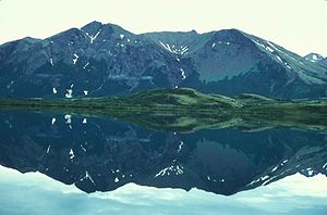
Togiak Lake
| Togiak Lake | ||
|---|---|---|

|
||
| Geographical location | Alaska (USA) | |
| Tributaries | Izavieknik River | |
| Drain | Togiak River | |
| Location close to the shore | Dillingham | |
| Data | ||
| Coordinates | 59 ° 38 ′ N , 159 ° 37 ′ W | |
|
|
||
| Altitude above sea level | 67 m | |
| surface | 39 km² | |
| length | 22.5 km | |
| width | 2.4 km | |
| volume | 2211 million m³ | |
| scope | 49 km | |
| Middle deep | 57 m | |
The Togiak Lake is a lake of glacial origin in southwestern Alaska .
The 39 km² Togiak Lake is located in the extreme east of the Togiak National Wildlife Refuge . The lake is 22.5 km long and up to 2.4 km wide in a north-south direction and is located in a valley that separates the Wood River Mountains to the east from the Ahklun Mountains to the west. Togiak Lake is at an altitude of 67 m .
The main tributary is the Izavieknik River , which flows in from Upper Togiak Lake to the north and drains the High Lake via its tributary Trail Creek .
Togiak Lake feeds the Togiak River . This flows from the southern shore of the lake over a distance of over 80 km to Bristol Bay .
Individual evidence
- ↑ Togiak Lake in the Geographic Names Information System of the United States Geological Survey
- ↑ a b c d Stacey J. Lowe, Steven Piazza, Patrick Walsh: Estimates of surface area and volume for 25 lakes, Togiak National Wildlife Refuge, southwestern Alaska (PDF, 2.8 MB) US Fish and Wildlife Service. January 2013. Retrieved December 22, 2017.
