Tokelau (Tuvalu)
| Tokelau | ||
|---|---|---|
|
|
||
| Coordinates | 6 ° 17 ′ S , 176 ° 19 ′ E | |

|
||
| Basic data | ||
| Country | Tuvalu | |
| Nanumanga | ||
| ISO 3166-2 | TV-NMG | |
| height | 11 m | |
| Residents | 245 (2012) | |
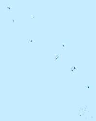
Tokelau is the administrative seat and capital of Nanumanga in the Pacific island state of Tuvalu . It is - besides Toga (formerly Tonga ) - the only village on the atoll comprising five islands. Tokelau is located in the west of the main island and has 245 inhabitants (as of 2012).
Tokelau has a hospital, church, post office, elementary school and fresh water source. It is located immediately southwest of the Vaiatoa lagoon . The second village of the atoll, Toga, borders the village in the south.
Web links
Individual evidence
- ↑ Nanumanga Locations. Retrieved from Citipedia.info on September 10, 2014
- ^ Tuvalu Online GIS. Tuvalu Central Statistics Office, January 2015, accessed January 8, 2015 .
- ↑ Map of Nanumaga. , JaneResture.com, date unknown retrieved September 10, 2014
