Tsing Yi
|
青衣 島 Tsing Yi Island |
||
|---|---|---|
| Tsing Yi promenade at night | ||
| Waters | South China Sea | |
| Geographical location | 22 ° 20 ′ 52 ″ N , 114 ° 6 ′ 0 ″ E | |
|
|
||
| surface | 10.25 km² | |
| Residents | approx. 200,000 19,512 inhabitants / km² |
|
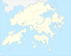
The island of Tsing Yi ( Chinese 青衣 島 / 青衣 岛 , Pinyin Qīngyī Dǎo , Jyutping Cing 1 ji 1 Dou 2 , English Tsing Yi Island ) is an island northwest of Hong Kong Island ; it belongs to the city of Hong Kong . With an area of around 10.69 km², it is the fifth largest island in Hong Kong. Around 200,000 people live on Tsing Yi today. Together with Kwai Chung , Tsing Yi is part of the Tsuen Wan New Town , which belongs to the Kwai Tsing district; this district is counted to the New Territories .
Tsing Yi ( 青衣 , qīngyī , Jyutping cing 1 ji 1 ) means something like "green (or black) clothing". However, there is also a fish that bears this name and that used to be found near the coast of the island.
The island has undergone drastic structural changes on the coast in recent decades, which have served to create more living space for the residents and efficient road connections (including to Hong Kong International Airport ). For example, the natural harbors and bays Tsing Yi Tong ( 青衣 塘 ), Mun Tsai Tong ( 門 仔 塘 / 门 仔 塘 ) and Tsing Yi Bay ( 青衣 灣 / 青衣 湾 ) in the northwest have been completely built on and thousands of new apartments have been partially built built skyscraper-like buildings. Tsing Yi is connected to the mainland by six bridges and to the smaller neighboring island of Ma Wan ( 馬 灣 / 马 湾 ) and Lantau by the Tsing Ma Bridge . The western part of the container terminal extends on the south-eastern edge of the island, while Hong Kong's mineral oil port is located on the west and south banks.


