Tsurugisan Quasi-National Park
|
Tsurugisan Quasi-National Park
|
||
|
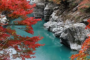
Iya valley in the park |
||
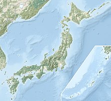
| location | Japan | |
| surface | 209.61 km² | |
| WDPA ID | 3271 | |
| Geographical location | 33 ° 54 ' N , 134 ° 6' E | |
|
|
||
| Setup date | March 3, 1964 | |
| administration | Tokushima Prefecture and Kōchi Prefecture | |
The Tsurugisan Quasi-National Park ( Japanese 剣 山 国 定 公園 Tsurugisan Kokutei Kōen ) is one of over 50 quasi-national parks in the prefectures of Tokushima and Kōchi in Japan. The Japanese Ministry of Environment is responsible for the management of the park. The park was founded on March 3, 1964 and covers an area of approx. 209.61 km². With the IUCN Category V, the park area is classified as a Protected Landscape / Protected Marine Area . In the park, next to Ishizuchi, is the eponymous mountain Tsurugi, at 1955 m the highest point in Shikoku . The Iya valley is also located in the park.
See also
Web links
Commons : Tsurugisan Quasi-National Park - Collection of pictures, videos and audio files
Individual evidence
- ↑ 剣 山 国 定 公園 . In: ブ リ タ ニ カ 国際 大 百科 事 典 小 項目 事 典 et alii at kotobank.jp. Retrieved December 20, 2019 (Japanese).

