Tuktoyaktuk
| Tuktoyaktuk | ||
|---|---|---|
 |
||
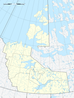
| Location in Canada | ||
|
|
||
| State : |
|
|
| Territory : | Northwest Territories | |
| Region: | Inuvik region | |
| Coordinates : | 69 ° 26 ′ N , 133 ° 2 ′ W | |
| Height : | 5 m | |
| Residents : | 898 (as of 2016) | |
| Municipality number: | 867 | |
| Postal code : | X0E 1C0 | |
| Area code : | +1 977 | |
| Foundation : | April 1, 1970 | |
| Mayor : | Darrel Nasogaluak | |
| Website : | www.tuktoyaktuk.ca | |
Tuktoyaktuk or Tuktuyaaqtuuq (literally "looks like a large caribou "), short Tuk (self-naming), is a town in Canada's Northwest Territories . It lies north of the Arctic Circle and is the second northernmost community on mainland Canada after Taloyoak . In 2016 Tuktoyaktuk had 898 residents.
The settlement is at a height of about five meters above the sea level at the Beaufort Sea belonging Kugmallit Bay and is surrounded by a plurality of small lakes. The Pingo Canadian Landmark is five kilometers west of the village .
Since November 15, 2017 there is a year-round road connection to Inuvik , 138 km away , the Inuvik – Tuktoyaktuk Highway (Northwest Territories Highway 10). This replaces the Tuktoyaktuk Winter Road , an ice road that can only be used temporarily in winter .
Web links
- Tuktoyaktuk entry in Legislative Assembly of the NWT (English)
Individual evidence
- ^ Inuvik Tuktoyaktuk - Official Opening Ceremonies. In: Communications and Public Affairs - Infrastructure. Government of Northwest Territories, accessed November 8, 2017 .
- ↑ Canadian Highway to the Arctic Ocean inaugurated. Retrieved November 18, 2017 .

