Turkish Airlines Flight 452
| Turkish Airlines Flight 452 | |
|---|---|
|
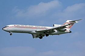
An identical aircraft from Turkish Airlines |
|
| Accident summary | |
| Accident type | controlled flight into terrain |
| place | near Isparta , Turkey |
| date | September 19, 1976 |
| Fatalities | 154 |
| Survivors | 0 |
| Aircraft | |
| Aircraft type | Boeing 727 -2F2 |
| operator | Turkish Airlines |
| Mark | TC-JBH |
| Surname | Antalya |
| Departure airport | Istanbul Yeşilköy Airport |
| Destination airport | Antalya Airport |
| Passengers | 146 |
| crew | 8th |
| Lists of aviation accidents | |
On September 19, 1976, a Boeing 727-200 crashed on Turkish Airlines flight 452 . The machine flew about 95 km from the destination airport Antalya near Isparta against the mountain Koçtepe. The accident occurred as a result of a pilot's error during the landing approach. To this day (as of 2017) it is the worst aircraft accident on Turkish soil.
plane
The aircraft was delivered to Turkish Airlines by Boeing in 1974. The first flight took place on November 11, 1974.
the accident
The Boeing 727 was to make a scheduled flight from Milan ( Italy ) with a stopover in Istanbul to Antalya . At 10:45 p.m. local time (8:45 p.m. UTC ), the machine took off from Istanbul for its onward flight to Antalya. The domestic flight was not carried out in accordance with instrument flight rules (IFR) , as was otherwise common in commercial aviation at that time, but in accordance with visual flight rules (VFR) . The estimated flight time from Istanbul to Antalya was just under an hour.
After passing the rotating radio beacon (VOR) Afyon, 210 kilometers north of Antalya, the pilots applied for clearance to descend from the cruising altitude of 7630 meters ( flight level 250) to 3960 meters (flight level 130).
At 11:11 p.m., about half an hour before the planned landing, the pilots reported to the air traffic controller in Antalya that they could already see the lights of the city of Antalya with its 4,000-meter-long boulevard and asked him to clear him for a direct approach the runway 36 at. The air traffic controller gave permission for a 180-degree turn over the city as well as the clearance to then proceed to the final approach .
The descent continued until the aircraft flew against Mount Koçtepe at an altitude of about 1130 meters (3700 feet) south of the outskirts of Isparta. The site of the accident is about 95 km north of the destination airport.
It appears that the pilots confused the lights on a street north of Isparta with those on the boulevard in Antalya and misjudged their position.
Web links
Individual evidence
- ^ Accident report B-727-200 TC-JBH , Aviation Safety Network (English), accessed on September 6, 2016.
Coordinates: 37 ° 44 ′ 23 ″ N , 30 ° 33 ′ 8 ″ E
