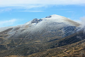
Uludag
| Uludag | ||
|---|---|---|
| height | 2542 m | |
| location | Bursa Province , Turkey | |
| Coordinates | 40 ° 4 '10 " N , 29 ° 13' 17" E | |
|
|
||
The Uludağ ([ uˈludɑː ], mighty mountain , from Turkish ulu , mighty, sublime and dağ , mountain , in ancient and Byzantine times Greek Όλυμπος , see also Olymp ) is a 2542 m high mountain in western Turkey and the highest point of the Marmara region . The mountain, on the northern slopes of which the city of Bursa is located, is used for winter sports, among other things. A 31-kilometer mountain road connects the city center with the winter sports area located between 1900 and 2100 m altitude.
There are warm springs in the vicinity of Uludağ. The wider area surrounding the summit including the winter sports area is designated as a national park and accessible for an entrance fee.
Also known as Mysian or Bithynian Olympus , it is also equated with the mountain from which, according to Greek legend, the gods pursued the Trojan War .
The lemonade Uludağ Gazoz , also known in German-speaking countries, comes from the Uludağ area and was previously made exclusively from the spring water of the mountain.
The Uludağ University in Bursa also owes its name to the mountain.


