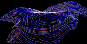
Irregular triangular mesh

An irregular triangular network ( English Triangulated Irregular Network , TIN ) is a way of modeling surfaces on the basis of a 3D point cloud ( mass points ). TINs are used for the digital terrain display , e.g. B. in geographic information systems .
In order to obtain a surface, the mass points are meshed triangularly, creating a network structure: By triangulating these support points of the model, edges are created and the triangles delimited by the edges are filled with an area (a linear interpolation ). Since the triangulation of a point set is not unique (for with ), triangulation criteria are required. An important criterion is the so-called Delaunay triangulation .
The surfaces generated run through clearly defined points, which means that there is no loss of accuracy due to interpolation. B. can show breaklines in the terrain exactly.
Since these are flat triangles, an "angular" terrain representation is created with the appropriate size. Since the distribution of the mass points can be irregular, areas with high relief energy can be modeled precisely by increasing the point density and points can also be introduced later. Due to the clear point definition, each point can only have one height value, which excludes negative gradients ( 2.5D representation).
storage
There are two different methods of storing a TIN:
- Surfaces
- node
Surfaces
Each triangle is identified with a unique key (ID). When you save a surface, the neighboring surfaces are also saved. Two tables are created for this. A triangle table contains the ID of the triangle, the nodes that make up the triangle, and the IDs of the adjacent triangles. A node table contains the IDs of the nodes and their coordinates (x, y, z).
This form of storage is advantageous for area-related analyzes ( slopes , surface runoff).
node
There is only one table. The node name, the coordinates (x, y, z) and the neighboring nodes are saved in this. So the edge structure is recorded.
This storage is used for contour lines or when creating terrain profiles .


