Upernivik (Uummannaq)
| Upernivik | ||
|---|---|---|
| Aerial view from the southwest of Upernivik | ||
| Waters | Uummannaq Fjord / Baffin Bay | |
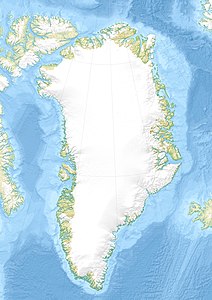
| Geographical location | 71 ° 16 ′ N , 52 ° 45 ′ W | |
|
|
||
| length | 30 km | |
| width | 23.2 km | |
| surface | 540 km² | |
| Highest elevation | Palup Qaqqaa 2105 m |
|
| Residents | uninhabited | |
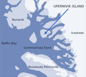
| Location of Upernivik in the Uummannaq Fjord | ||
Upernivik ( Danish Upernivik Ø ) is an uninhabited, mountainous island in the Uummannaq Fjord in western Greenland . The highest point of the 540 km² island, located 2105 m above sea level, is the Palup Qaqqaa . Administratively, the island belongs to the large commune Avannaata Kommunia .
The island is separated from mainland Greenland by the Inukavsait in the north (2.6 km wide to the Akuliaruseq peninsula ) and Paakassaa (3.8 km wide).
See also
Individual evidence
- ↑ Per Ivar Haug: Gazetteer of Greenland ( Memento of the original from June 15, 2011 in the Internet Archive ) Info: The archive link was inserted automatically and has not yet been checked. Please check the original and archive link according to the instructions and then remove this notice. (= Til Oppslysning 15). Universitetsbiblioteket i Trondheim, Trondheim 2005. ISBN 82-7113-114-1 (English)
- ↑ Palup Qaqqaa at Peakbagger.com (English)


