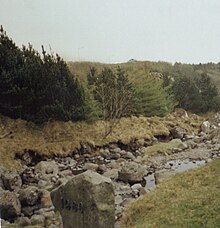
Viðarlundin úti í Grøv
Viðarlundin úti í Grøv is a forest near the town of Klaksvík on the Faroese island of Borðoy . It consists mainly of ash, birch and spruce and is located around 1 km southeast of the city on the road 752 to Norðoyri . The Faroese word viðarlund literally means “wood” and describes a park or forest in the Faroe Islands , of which only 0.06% is forested.
The city council of Klaksvík decided on September 14, 1979 to create a forest on the "Grøv" site, Flur 1621, not far south-east of the city. The forest was planted from 1980 on an area of 33,000 m².
In 2006 the Viðarlundin úti í Grøv was considerably expanded to the northeast over the road 752 to a waterfall. Numerous other trees were planted, several additional paths laid out and benches set up. Mainly spruce and Japanese larch ( Larix kaempferi ) were replanted.
The Viðarlundin úti í Grøv is a popular destination and one of the attractions of the city Klaksvík. A torrent flows through it, where you can grill, and the waterfall in the northeast forms a pond that is open for swimming. A memorial stone with the year 1980 was set up on the torrent to commemorate the establishment of the facility. The forest surrounds a semi-circular meadow on which the oval, overgrown remains of a building from the Viking Age that have not been excavated can be seen. Like all forests and parks in the Faroe Islands outside the capital Tórshavn , Viðarlundin úti í Grøv is fenced in to protect the trees from sheep foraging.
Individual evidence
- ↑ Højgaard, Andrias: Træplanting í í Føroyum eina Old 43. Tórshavn 1989
- ↑ Fleiri gøtur úti í Grøv , Norðlýsið: January 13, 2006.
- ↑ http://www.dendrologi.dk/FaroeSkovKlaksvik.htm
Coordinates: 62 ° 13 ′ 30 " N , 6 ° 33 ′ 43" W.

